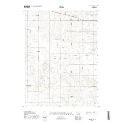
2018 Map of Lockridge West
USGS Topo · Published 2018About this map
Lockridge stands at the northern edge of this landscape, where the Jefferson County prairie transitions into the drainage networks of Cedar Creek. This 2018 survey reveals a rural territory defined by its family and community burial grounds, including the Jones Family Cem and the Pioneer Cem south of Stockport Rd. The distribution of these sites, alongside the Bonnifield Cem and Mount Zion Cem, reflects a deeply rooted settlement pattern established well before the modern road grid.
Find a feature on this map
75 named features on this map. Tap any name to fly to it.
Don’t see what you’re looking for? This feature index may not catch every label — zoom into the map to look around manually.
Map Details
Editions of this 2018 Lockridge West Map
This is the sole edition of this map. No revisions or reprints were ever made.
Other maps of this area

1958 · Burlington
USGS Topo · 1:250,000

1958 · Davenport
USGS Topo · 1:250,000

1961 · Burlington
USGS Topo · 1:250,000

1961 · Davenport
USGS Topo · 1:250,000

1962 · Davenport
USGS Topo · 1:250,000

1963 · Burlington
USGS Topo · 1:250,000
1980 · Fairfield North
USGS Topo · 1:24,000
1980 · Fairfield South
USGS Topo · 1:24,000

1980 · Lockridge West
USGS Topo · 1:24,000

1980 · Trenton
USGS Topo · 1:24,000