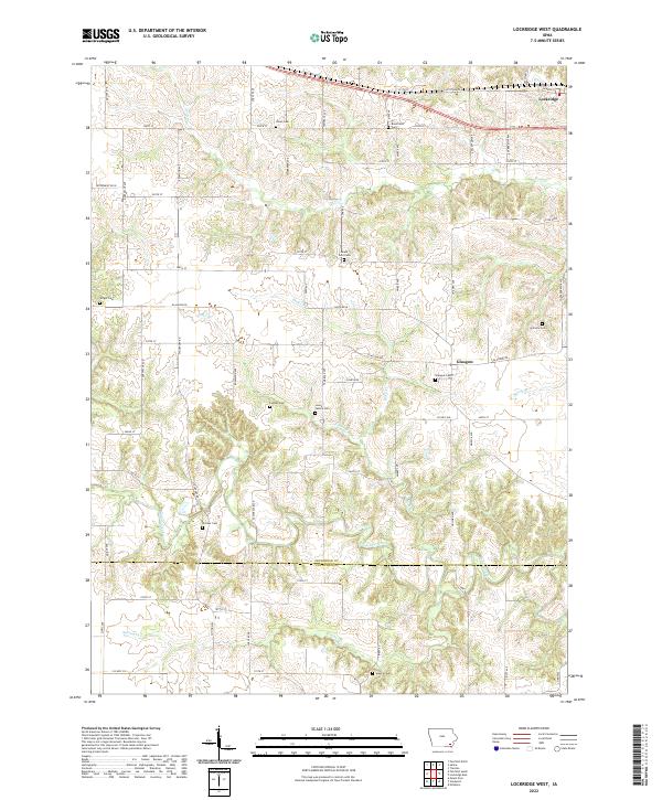
2022 Map of Lockridge West
USGS Topo · Published 2022About this map
Cedar Creek meanders along the border of Jefferson and Van Buren Counties, carving a distinct valley through the agricultural landscape. The region is defined by a dense network of local roads such as Stockport Rd and Sassafrass Blvd that link isolated farmsteads and small crossroads communities. Near the northern edge, the settlement of Lockridge sits along Highway 34, while the hamlet of Glasgow remains centered around Glasgow Rd.
Find a feature on this map
74 named features on this map. Tap any name to fly to it.
Don’t see what you’re looking for? This feature index may not catch every label — zoom into the map to look around manually.
Map Details
Editions of this 2022 Lockridge West Map
This is the sole edition of this map. No revisions or reprints were ever made.
Other maps of this area

1958 · Burlington
USGS Topo · 1:250,000

1958 · Davenport
USGS Topo · 1:250,000

1961 · Burlington
USGS Topo · 1:250,000

1961 · Davenport
USGS Topo · 1:250,000

1962 · Davenport
USGS Topo · 1:250,000

1963 · Burlington
USGS Topo · 1:250,000
1980 · Fairfield North
USGS Topo · 1:24,000
1980 · Fairfield South
USGS Topo · 1:24,000

1980 · Lockridge West
USGS Topo · 1:24,000

1980 · Trenton
USGS Topo · 1:24,000