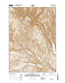
2014 Map of Log Creek
USGS Topo · Published 2014About this map
Bully Cr and its northern forks define the high-desert drainages of this Malheur County landscape. The 2014 survey reveals an arid territory where water management is critical, evidenced by the distribution of several catchment points including Saddle Reservoir, Becker Reservoir, and the Ridge Road Reservoir. These features, alongside Log Or Basin Reservoir, support livestock and local land use in a region dominated by relief features like Stoney Gulch and Hay Canyon. Transport through this part of the Oregon interior is facilitated by historic routes such as Bonita Rd and Bully Creek Rd, which provide access to the broader township and range grid. The presence of Richter Flat and the deep incisions of Timber Canyon illustrate the sharp transitions between elevated basins and the lower creek beds that sustain the area's hydrology.
Find a feature on this map
27 named features on this map. Tap any name to fly to it.
Don’t see what you’re looking for? This feature index may not catch every label — zoom into the map to look around manually.
Map Details
Editions of this 2014 Log Creek Map
This is the sole edition of this map. No revisions or reprints were ever made.
Other maps of this area

1955 · Baker
USGS Topo · 1:250,000

1955 · Boise
USGS Topo · 1:250,000

1958 · Boise
USGS Topo · 1:250,000

1959 · Baker
USGS Topo · 1:250,000

1962 · Boise
USGS Topo · 1:250,000

1964 · Brogan
USGS Topo · 1:62,500

1966 · Clover Creek Ranch
USGS Topo · 1:62,500

1966 · Harper
USGS Topo · 1:62,500

1966 · Westfall Butte
USGS Topo · 1:62,500

1980 · Brogan
USGS Topo · 1:100,000