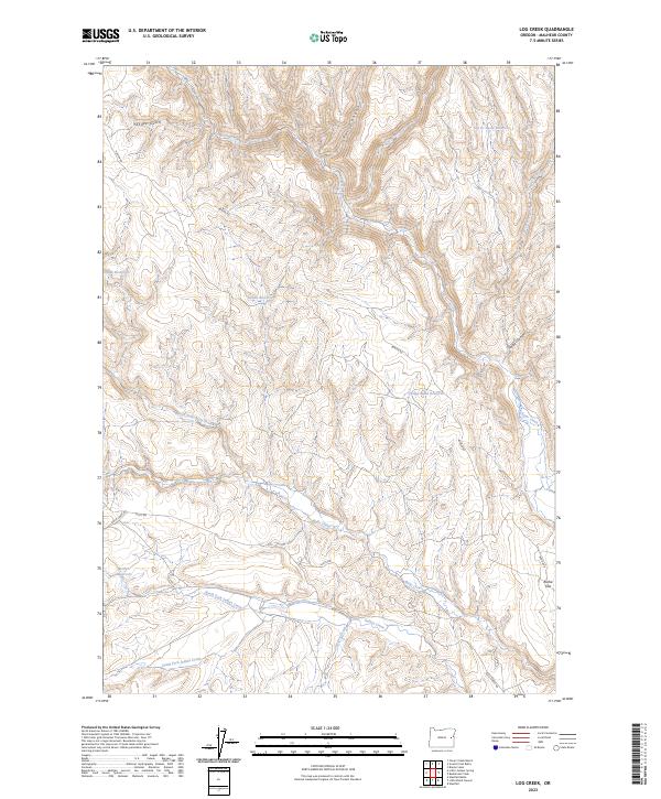
2023 Map of Log Creek
USGS Topo · Published 2023About this map
Bully Creek and its many branches dominate the drainage patterns of this high-desert landscape in Malheur County, where water management is clearly the primary driver of development. The terrain is defined by a sophisticated network of small-scale impoundments including Log Cr Basin Reservoir, Becker Reservoir, and Saddle Reservoir, which likely serve local ranching interests. These water sources are connected by a sparse road network, notably Bully Creek Rd and Bonita Rd, which navigate the various canyons and gulches.
Find a feature on this map
28 named features on this map. Tap any name to fly to it.
Don’t see what you’re looking for? This feature index may not catch every label — zoom into the map to look around manually.
Map Details
Editions of this 2023 Log Creek Map
This is the sole edition of this map. No revisions or reprints were ever made.
Other maps of this area

1955 · Baker
USGS Topo · 1:250,000

1955 · Boise
USGS Topo · 1:250,000

1958 · Boise
USGS Topo · 1:250,000

1959 · Baker
USGS Topo · 1:250,000

1962 · Boise
USGS Topo · 1:250,000

1964 · Brogan
USGS Topo · 1:62,500

1966 · Clover Creek Ranch
USGS Topo · 1:62,500

1966 · Harper
USGS Topo · 1:62,500

1966 · Westfall Butte
USGS Topo · 1:62,500

1980 · Brogan
USGS Topo · 1:100,000