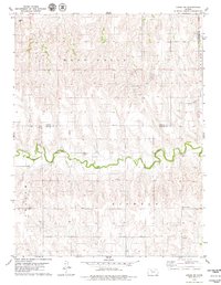
1979 Map of Logan SW
USGS Topo · Published 1979About this map
Bow Creek winds through this rural Kansas landscape, carving a prominent valley across the border of Norton and Graham counties. During the late 1970s, the region’s economy was defined by the intersection of traditional land use and natural resource extraction, as seen in the West Union Oil Field and the adjacent Oil Field to the east. These industrial sites sit atop the high ground overlooking the creek basin, which is dotted with evidence of earlier settlement and civic life.
Find a feature on this map
11 named features on this map. Tap any name to fly to it.
Don’t see what you’re looking for? This feature index may not catch every label — zoom into the map to look around manually.
Map Details
Editions of this 1979 Logan SW Map
This is the sole edition of this map. No revisions or reprints were ever made.
Other maps of this area

1893 · Norton
USGS Topo · 1:125,000

1893 · Hill
USGS Topo · 1:125,000

1955 · Beloit
USGS Topo · 1:250,000

1959 · Beloit
USGS Topo · 1:250,000

1969 · Nicodemus
USGS Topo · 1:24,000

1978 · Logan
USGS Topo · 1:24,000

1978 · Edmond
USGS Topo · 1:24,000
1978 · Densmore
USGS Topo · 1:24,000

1978 · Edmond SE
USGS Topo · 1:24,000
1979 · Logan SE
USGS Topo · 1:24,000