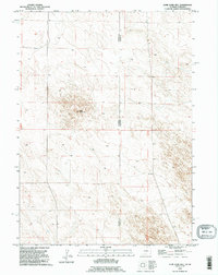
1990 Map of Lone Sand Hill
USGS Topo · Published 1995About this map
Lone Sand Hill rises as the primary landmark in this desolate corner of the High Plains, where the border between Wyoming and Nebraska meets. Based on imagery from 1973 and revised in 1990, the survey documents a landscape defined by its political boundaries and sparse water sources rather than human settlement. The state line divides Goshen County and Sioux County, marking a transition between the grazing lands of the two states. Beyond the topographic relief of the sand hill itself, the only notable evidence of infrastructure is a lone well in the northwest, highlighting the critical importance of groundwater management in this arid ranching environment during the late twentieth century.
Find a feature on this map
4 named features on this map. Tap any name to fly to it.
Don’t see what you’re looking for? This feature index may not catch every label — zoom into the map to look around manually.
Map Details
Editions of this 1990 Lone Sand Hill Map
This is the sole edition of this map. No revisions or reprints were ever made.
Other maps of this area

1896 · Patrick
USGS Topo · 1:125,000

1899 · Whistle Creek
USGS Topo · 1:125,000

1954 · Torrington
USGS Topo · 1:250,000

1955 · Alliance
USGS Topo · 1:250,000

1957 · Alliance
USGS Topo · 1:250,000

1958 · Torrington
USGS Topo · 1:250,000

1958 · Alliance
USGS Topo · 1:250,000

1974 · Spoon Butte SW
USGS Topo · 1:24,000

1974 · Spoon Butte
USGS Topo · 1:24,000

1977 · Van Tassell SE
USGS Topo · 1:24,000