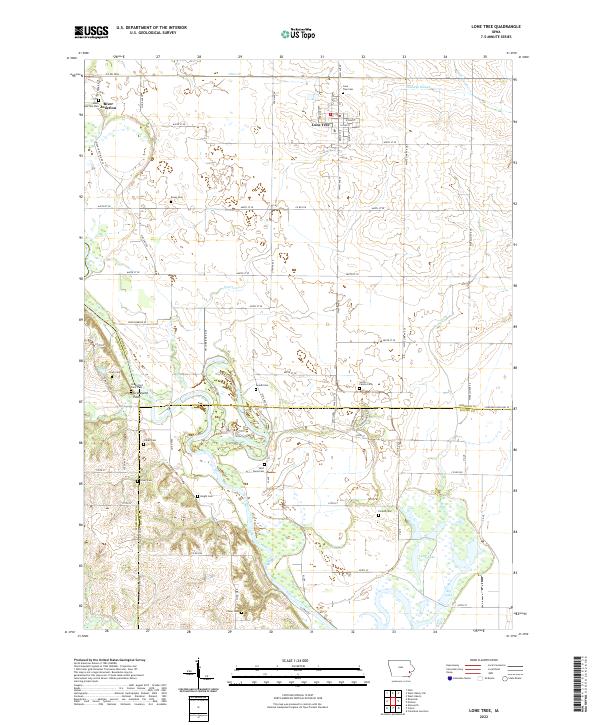
2022 Map of Lone Tree
USGS Topo · Published 2022About this map
Lone Tree and River Junction serve as the primary anchors of this eastern Iowa landscape, situated where the Iowa River meanders through a dense network of wetlands and oxbows. The river's influence is evident in the presence of Big Lake and Long Lake to the southeast, alongside several smaller drainages like Otter Cr and Prairie Cr. This 2022 survey captures a high concentration of small family and local burial grounds, providing an exceptional resource for genealogical research.
Find a feature on this map
76 named features on this map. Tap any name to fly to it.
Don’t see what you’re looking for? This feature index may not catch every label — zoom into the map to look around manually.
Map Details
Editions of this 2022 Lone Tree Map
This is the sole edition of this map. No revisions or reprints were ever made.
Other maps of this area

1891 · Iowa City
USGS Topo · 1:62,500

1894 · West Liberty
USGS Topo · 1:62,500

1901 · Stanwood
USGS Topo · 1:125,000

1903 · Fairfax
USGS Topo · 1:125,000

1938 · Iowa City
USGS Topo · 1:62,500

1958 · Davenport
USGS Topo · 1:250,000

1961 · Davenport
USGS Topo · 1:250,000

1962 · Davenport
USGS Topo · 1:250,000
1965 · West Liberty
USGS Topo · 1:24,000
1965 · West Liberty SW
USGS Topo · 1:24,000