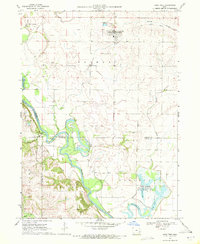
1969 Map of Lone Tree
USGS Topo · Published 1972About this map
Lone Tree stands as a primary focal point in the northeast corner of this eastern Iowa landscape, situated just south of a remnant Old Railroad Grade. To the west, the confluence of Iowa River and English River near River Junction creates a complex network of wetlands and oxbows, including Horseshoe Lake, Long Lake, and Big Lake. These waters feed into the expansive Cone Marsh State Wildlife Management Area in Oakland township.
Find a feature on this map
33 named features on this map. Tap any name to fly to it.
Don’t see what you’re looking for? This feature index may not catch every label — zoom into the map to look around manually.
Map Details
Editions of this 1969 Lone Tree Map
This is the sole edition of this map. No revisions or reprints were ever made.
Other maps of this area

1891 · Iowa City
USGS Topo · 1:62,500

1894 · West Liberty
USGS Topo · 1:62,500

1901 · Stanwood
USGS Topo · 1:125,000

1903 · Fairfax
USGS Topo · 1:125,000

1938 · Iowa City
USGS Topo · 1:62,500

1958 · Davenport
USGS Topo · 1:250,000

1961 · Davenport
USGS Topo · 1:250,000

1962 · Davenport
USGS Topo · 1:250,000
1965 · West Liberty
USGS Topo · 1:24,000
1965 · West Liberty SW
USGS Topo · 1:24,000