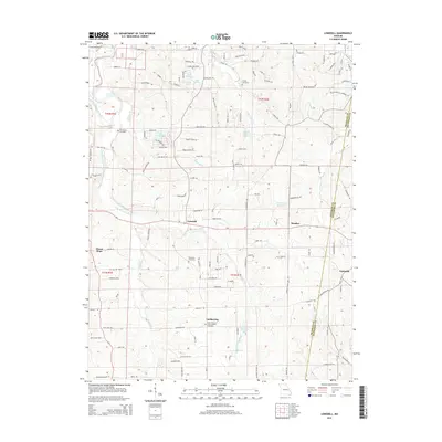
2015 Map of Lonedell
USGS Topo · Published 2015About this map
Lonedell sits near the heart of this landscape where the Little Meramec River and Johnson Br wind through the terrain of Franklin and Jefferson Counties. The area is defined by small, clustered settlements and residential developments like Green Tree Acrs and Linda Ln Est, reflecting a modern rural-suburban character. Water is a central element, with several significant impoundments including the Al Swantner Reservoir, Lake Arrowhead, and Williams Lake.
Find a feature on this map
97 named features on this map. Tap any name to fly to it.
Don’t see what you’re looking for? This feature index may not catch every label — zoom into the map to look around manually.
Map Details
Editions of this 2015 Lonedell Map
This is the sole edition of this map. No revisions or reprints were ever made.
Other maps of this area

1901 · De Soto
USGS Topo · 1:125,000

1937 · Pacific
USGS Topo · 1:24,000

1937 · Fletcher
USGS Topo · 1:24,000

1938 · Cedar Hill
USGS Topo · 1:24,000

1938 · Fletcher
USGS Topo · 1:24,000

1940 · Cedar Hill
USGS Topo · 1:24,000

1946 · Richwoods
USGS Topo · 1:62,500

1947 · St. Clair
USGS Topo · 1:62,500

1948 · Richwoods
USGS Topo · 1:62,500

1949 · Saint Louis
USGS Topo · 1:250,000