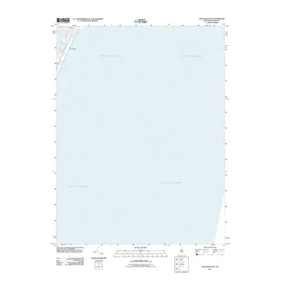
2011 Map of Long Beach NE
USGS Topo · Published 2011About this map
Long Beach occupies a thin strip of coastal land on this eastern New Jersey quadrangle, separating the vast Atlantic Ocean from the sheltered waters of Barnegat Bay. The map focuses primarily on the offshore maritime environment, but captures the northwestern tip of the barrier island at Barnegat, where the grid of local streets begins to take shape. Residential development is anchored along Bayview Ave, providing a detailed look at the interface between the shore and the bay in the early 21st century. The survey provides an essential perspective on the geography of this vulnerable coastline before major modern storm events altered the local landscape.
Find a feature on this map
6 named features on this map. Tap any name to fly to it.
Don’t see what you’re looking for? This feature index may not catch every label — zoom into the map to look around manually.
Map Details
Editions of this 2011 Long Beach NE Map
This is the sole edition of this map. No revisions or reprints were ever made.
Other maps of this area

1888 · Barnegat
USGS Topo · 1:62,500

1888 · Long Beach
USGS Topo · 1:62,500

1893 · Long Beach
USGS Topo · 1:62,500

1893 · Barnegat
USGS Topo · 1:62,500

1898 · Barnegat
USGS Topo · 1:62,500

1919 · Long Beach
USGS Topo · 1:62,500

1919 · Barnegat
USGS Topo · 1:62,500

1941 · Toms River
USGS Topo · 1:62,500
1941 · Long Beach
USGS Topo · 1:62,500

1946 · Wilmington
USGS Topo · 1:250,000