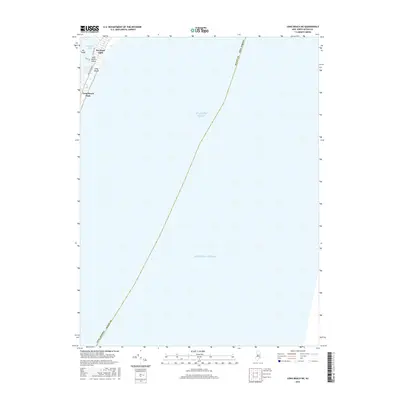
2016 Map of Long Beach NE
USGS Topo · Published 2016About this map
Barnegat Light stands at the northern tip of the barrier island on this coastal survey, where the land meets the narrow inlet between the Atlantic Ocean and Barnegat Bay. The map focuses primarily on the offshore expanse of the Atlantic, though it captures the critical northern residential and recreational interface of Long Beach Island. Street-level detail includes the primary thoroughfare of Long Beach Blvd and local residential lanes like Holly Dr and Bayview Ave. This edition documents the shoreline of Long Beach and the protected grounds of Long Beach Park as they appeared in 2016. The marshy terrain of Vol Sedge is visible just west of the settled area, illustrating the delicate balance of the Jersey Shore's maritime environment.
Find a feature on this map
13 named features on this map. Tap any name to fly to it.
Don’t see what you’re looking for? This feature index may not catch every label — zoom into the map to look around manually.
Map Details
Editions of this 2016 Long Beach NE Map
This is the sole edition of this map. No revisions or reprints were ever made.
Other maps of this area

1888 · Barnegat
USGS Topo · 1:62,500

1888 · Long Beach
USGS Topo · 1:62,500

1893 · Long Beach
USGS Topo · 1:62,500

1893 · Barnegat
USGS Topo · 1:62,500

1898 · Barnegat
USGS Topo · 1:62,500

1919 · Long Beach
USGS Topo · 1:62,500

1919 · Barnegat
USGS Topo · 1:62,500

1941 · Toms River
USGS Topo · 1:62,500
1941 · Long Beach
USGS Topo · 1:62,500

1946 · Wilmington
USGS Topo · 1:250,000