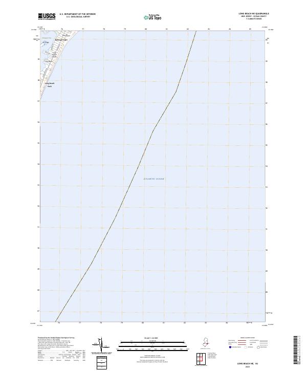
2023 Map of Long Beach NE
USGS Topo · Published 2023About this map
Barnegat Light stands at the northern tip of Long Beach Island, where the narrow coastal barrier meets the inlet. This modern topographic survey highlights the late-era development of the northern shore, where Long Beach and its surrounding residential infrastructure sit between the Atlantic Ocean and the marshes of Barnegat Bay. The map reveals a densely gridded residential layout, with prominent thoroughfares like Long Beach Blvd and Central Ave serving as the spine of the community. In the bay, the salt marshes of Vol Sedge represent the tidewater landscape that has long defined the interior of the Jersey Shore. Public spaces like Long Beach Park are preserved among the coastal blocks, showing how the 21st-century shoreline balances high-density housing with public access.
Find a feature on this map
11 named features on this map. Tap any name to fly to it.
Don’t see what you’re looking for? This feature index may not catch every label — zoom into the map to look around manually.
Map Details
Editions of this 2023 Long Beach NE Map
This is the sole edition of this map. No revisions or reprints were ever made.
Other maps of this area

1888 · Barnegat
USGS Topo · 1:62,500

1888 · Long Beach
USGS Topo · 1:62,500

1893 · Long Beach
USGS Topo · 1:62,500

1893 · Barnegat
USGS Topo · 1:62,500

1898 · Barnegat
USGS Topo · 1:62,500

1919 · Long Beach
USGS Topo · 1:62,500

1919 · Barnegat
USGS Topo · 1:62,500

1941 · Toms River
USGS Topo · 1:62,500
1941 · Long Beach
USGS Topo · 1:62,500

1946 · Wilmington
USGS Topo · 1:250,000