
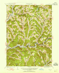
1921 Map of Long Eddy
USGS Topo · Published 1921About this map
The Delaware River cuts through this borderland landscape, separating Wayne County, Pennsylvania from the hills of New York as they appeared in 1920. This survey shows a rural economy organized around numerous small schoolhouses, such as Hankins School, Price School, and Pine Mill School, which served the scattered residents of Hilltown and Abrahamsville.
Find a feature on this map
42 named features on this map. Tap any name to fly to it.
Don’t see what you’re looking for? This feature index may not catch every label — zoom into the map to look around manually.
Map Details
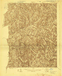
Editions of this 1921 Long Eddy Map
This is the sole edition of this map. No revisions or reprints were ever made.
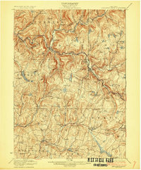
Other maps of this area

1892 · Honesdale
USGS Topo · 1:62,500

1920 · Long Eddy
USGS Topo · 1:62,500

1920 · Damascus
USGS Topo · 1:62,500

1921 · Livingston Manor
USGS Topo · 1:62,500

1922 · White Lake
USGS Topo · 1:62,500
1922 · Andes
USGS Topo · 1:62,500

1923 · Damascus
USGS Topo · 1:62,500

1923 · Long Eddy
USGS Topo · 1:62,500
1923 · Walton
USGS Topo · 1:48,000
1923 · Livingston Manor
USGS Topo · 1:62,500