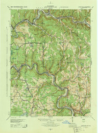
1944 Map of Long Eddy
USGS Topo · Published 1944About this map
The Delaware River snakes through a deeply dissected landscape on this mid-century survey, forming the natural boundary between New York and Pennsylvania. Small river settlements and rail stops like Long Eddy and Equinunk anchor a region defined by its waterway and the winding tracks of the Erie RR. The map captures a moment when rural life centered around a dense network of country schoolhouses, including the South Branch Sch, Lester Sch, and Kellams Sch, many of which served isolated valley communities like Rock Valley and Burnwood.
Find a feature on this map
76 named features on this map. Tap any name to fly to it.
Don’t see what you’re looking for? This feature index may not catch every label — zoom into the map to look around manually.
Map Details
Editions of this 1944 Long Eddy Map
This is the sole edition of this map. No revisions or reprints were ever made.
Other maps of this area

1892 · Honesdale
USGS Topo · 1:62,500

1920 · Long Eddy
USGS Topo · 1:62,500

1920 · Damascus
USGS Topo · 1:62,500

1921 · Long Eddy
USGS Topo · 1:48,000

1921 · Livingston Manor
USGS Topo · 1:62,500

1922 · White Lake
USGS Topo · 1:62,500

1922 · Andes
USGS Topo · 1:62,500

1923 · Damascus
USGS Topo · 1:62,500

1923 · Long Eddy
USGS Topo · 1:62,500

1923 · Walton
USGS Topo · 1:48,000