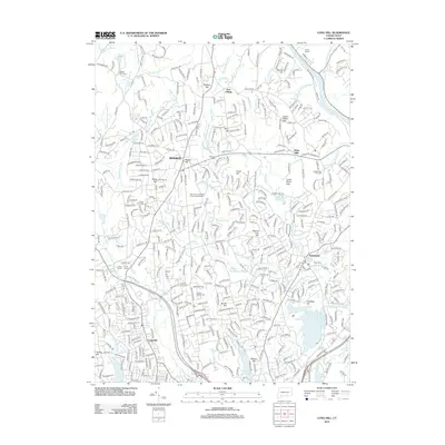
2012 Map of Long Hill
USGS Topo · Published 2012About this map
Monroe and Huntington are centers of settlement in this Fairfield County landscape, where the terrain is defined by a series of prominent rises including Moose Hill, Israel Hill, and Booth Hill. This 2012 survey illustrates the extensive water infrastructure that serves the region, dominated by the Isinglass Reservoir, Trap Falls Reservoir, and Means Brook Reservoir. The Housatonic River forms a portion of the eastern boundary, fed by tributaries like the Halfway River and Isinglass River. Genealogists and local historians will find significant detail in the numerous burial grounds documented, such as Walker Farm Cem, Saint John the Baptist Greek Catholic Cem, and the Lower White Hills Cem. The presence of the Cutlers Farm Sch and recreational sites like Camp Palmer and Camp Trefoil reflects the area's developed suburban and community character.
Find a feature on this map
73 named features on this map. Tap any name to fly to it.
Don’t see what you’re looking for? This feature index may not catch every label — zoom into the map to look around manually.
Map Details
Editions of this 2012 Long Hill Map
This is the sole edition of this map. No revisions or reprints were ever made.
Other maps of this area

1889 · Derby
USGS Topo · 1:62,500

1891 · Bridgeport
USGS Topo · 1:62,500

1891 · Derby
USGS Topo · 1:62,500

1892 · Danbury
USGS Topo · 1:62,500

1892 · Norwalk
USGS Topo · 1:62,500

1893 · Bridgeport
USGS Topo · 1:62,500

1893 · Norwalk
USGS Topo · 1:62,500

1893 · Derby
USGS Topo · 1:62,500

1915 · Danbury
USGS Topo · 1:62,500

1920 · Bridgeport
USGS Topo · 1:62,500