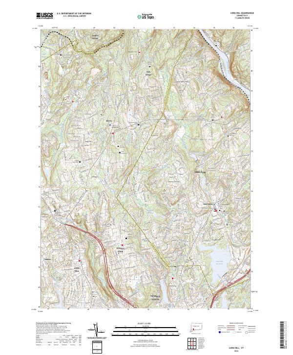
2024 Map of Long Hill
USGS Topo · Published 2024About this map
The Housatonic River forms a dominant boundary along the northeastern edge of this Connecticut landscape, where the modern developments of Shelton and Trumbull Center meet a complex network of reservoirs and historic burial grounds. Genealogists will find a significant concentration of local history at Gregory Four Corners Burial Ground and the Daniels Farm Burial Ground. The transition from rural roots to suburban expansion is visible in the placement of the Monroe Center School and the preservation of the Housatonic Rail Trail.
Find a feature on this map
394 named features on this map. Tap any name to fly to it.
Don’t see what you’re looking for? This feature index may not catch every label — zoom into the map to look around manually.
Map Details
Editions of this 2024 Long Hill Map
This is the sole edition of this map. No revisions or reprints were ever made.
Historical Maps of Oxford Through Time
4 maps found