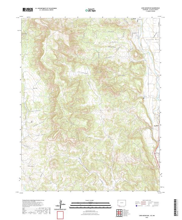
2022 Map of Long Mountain
USGS Topo · Published 2022About this map
The Animas River corridor shapes the eastern edge of this landscape, supporting the communities of La Posta and Bondad in La Plata County. While the river valley hosts the Citizens Animas Ditch and primary travel routes like Co Rd 213, the interior transitions into a complex system of plateaus and drainage basins. High points such as Sunnyside Mesa and Round Top Mtn overlook a series of deep cuts including High Flume Canyon, Cox Canyon, and Mitchell Canyon. The topography reveals the logistical challenges of the high desert, where roads like Black Ridge Rd and Indian Rte 114 follow the natural contours of the ridges. Genealogists will find the locations of the La Posta Cem and Elco Cem particularly useful for identifying family sites within these rural settlements.
Find a feature on this map
45 named features on this map. Tap any name to fly to it.
Don’t see what you’re looking for? This feature index may not catch every label — zoom into the map to look around manually.
Map Details
Editions of this 2022 Long Mountain Map
This is the sole edition of this map. No revisions or reprints were ever made.
Other maps of this area

1889 · Largo
USGS Topo · 1:250,000

1889 · Chaco
USGS Topo · 1:250,000

1892 · Chaco
USGS Topo · 1:250,000

1895 · Largo
USGS Topo · 1:250,000

1908 · Ignacio
USGS Topo · 1:125,000

1913 · Red Mesa
USGS Topo · 1:62,500

1924 · Ignacio
USGS Topo · 1:125,000

1945 · Durango
USGS Topo · 1:250,000

1953 · Durango
USGS Topo · 1:250,000

1954 · Durango
USGS Topo · 1:250,000