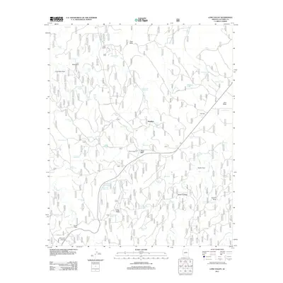
2011 Map of Long Valley
USGS Topo · Published 2011About this map
Long Valley and Wingfield anchor this portion of the Coconino Plateau, where the landscape is defined by an intricate network of drainage draws and livestock tanks essential to high-country ranching. The map illustrates a transition between the elevated flats of Bald Mesa and the complex canyon systems of Dirtyneck Canyon and Snake Draw. A notable concentration of water infrastructure, including Clints Well and numerous stock tanks like Chilson Mesa Tank and M Diamond Tank, reflects the area's history as a hub for both transit and range management.
Find a feature on this map
91 named features on this map. Tap any name to fly to it.
Don’t see what you’re looking for? This feature index may not catch every label — zoom into the map to look around manually.
Map Details
Editions of this 2011 Long Valley Map
This is the sole edition of this map. No revisions or reprints were ever made.
Other maps of this area

1887 · Verde
USGS Topo · 1:250,000

1892 · Verde
USGS Topo · 1:250,000

1934 · Pine
USGS Topo · 1:62,500

1934 · Promontory Butte
USGS Topo · 1:62,500

1939 · Promontory Butte
USGS Topo · 1:62,500

1940 · Pine
USGS Topo · 1:62,500

1952 · Pine
USGS Topo · 1:62,500

1952 · Promontory Butte
USGS Topo · 1:62,500

1954 · Holbrook
USGS Topo · 1:250,000

1957 · Holbrook
USGS Topo · 1:250,000