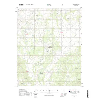
2018 Map of Long Valley
USGS Topo · Published 2018About this map
Coconino National Forest blankets the high country of the Mogollon Plateau in this detailed study of northern Arizona. The landscape is defined by its complex drainage network, where seasonal waterways like Long Valley Draw, Snake Draw, and Iron Mine Draw carve through the limestone and basalt terrain. Small settlements like Long Valley, Wingfield, and Clints Well serve as central points in a region dominated by timber and range management. The map reveals an intricate system of water management essential for high-elevation ranching and wildlife, featuring dozens of named collection points such as Peeks Point Tank Number Two, Dirtyneck Tank, and Snafu Tank. For those tracing local history or backcountry routes, the presence of named landmarks like McCarty Ridge and Bald Mesa provides clear orientation within this wooded expanse.
Find a feature on this map
88 named features on this map. Tap any name to fly to it.
Don’t see what you’re looking for? This feature index may not catch every label — zoom into the map to look around manually.
Map Details
Editions of this 2018 Long Valley Map
This is the sole edition of this map. No revisions or reprints were ever made.
Other maps of this area

1887 · Verde
USGS Topo · 1:250,000

1892 · Verde
USGS Topo · 1:250,000

1934 · Pine
USGS Topo · 1:62,500

1934 · Promontory Butte
USGS Topo · 1:62,500

1939 · Promontory Butte
USGS Topo · 1:62,500

1940 · Pine
USGS Topo · 1:62,500

1952 · Pine
USGS Topo · 1:62,500

1952 · Promontory Butte
USGS Topo · 1:62,500

1954 · Holbrook
USGS Topo · 1:250,000

1957 · Holbrook
USGS Topo · 1:250,000