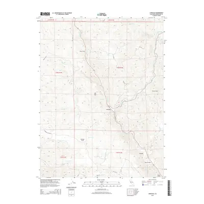
2015 Map of Longvale
USGS Topo · Published 2015About this map
Longvale sits at the junction of the canyon floor and the surrounding hills, where Long Valley Cr meets the winding Outlet Creek. This 2015 U.S. Geological Survey representation of the Mendocino County interior reveals a landscape of steep topography and named drainage systems. To the south, the settlement of Arnold marks the entrance to Reeves Canyon, while the western portion of the map is defined by the broad expanse of Sherwood Valley. The transportation network is a mix of highway corridors and smaller local tracks like Old Sherwood Rd and Sherwood Rancheria Rd, providing access to the more isolated landmarks such as Sam Watt Rock and Shimmin Ridge. The numerous creek labels, including Curly Cow Cr and Dutch Henry Cr, illustrate the complex watershed that defines this portion of the California Coast Range.
Find a feature on this map
36 named features on this map. Tap any name to fly to it.
Don’t see what you’re looking for? This feature index may not catch every label — zoom into the map to look around manually.
Map Details
Editions of this 2015 Longvale Map
This is the sole edition of this map. No revisions or reprints were ever made.
Other maps of this area

1920 · Glenblair
USGS Topo · 1:62,500

1921 · Branscomb
USGS Topo · 1:62,500

1922 · Willits
USGS Topo · 1:62,500

1942 · Willits
USGS Topo · 1:62,500

1943 · Glenblair
USGS Topo · 1:62,500

1944 · Willits
USGS Topo · 1:62,500

1951 · Branscomb
USGS Topo · 1:62,500

1951 · Laytonville
USGS Topo · 1:62,500

1957 · Ukiah
USGS Topo · 1:250,000

1960 · Ukiah
USGS Topo · 1:250,000