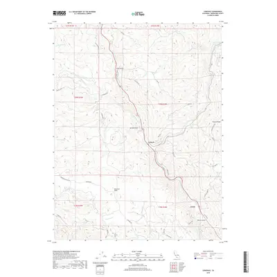
2018 Map of Longvale
USGS Topo · Published 2018About this map
Longvale and Arnold sit along the central corridor of this Mendocino County landscape, where the confluence of several water systems defines the local topography. The map illustrates a transition from the narrow canyon of Wilson Gulch to the broader expanse of Sherwood Valley. To the west, the Sherwood Rancheria Rd provides access to the interior hills, while the S Fork Eel River and Outlet Creek drain the surrounding heights. This 2018 survey reveals a network of ridges and drainages, including Shimmin Ridge and the deep cut of Reeves Canyon. Unique landmarks such as Sam Watt Rock and the Boneta Corals offer specific points of interest for those researching the land use and natural features of the region north of Willits. The mapping of numerous local roads like Black Bear Rd and Skyview Rd indicates modern residential and agricultural development throughout the rugged terrain.
Find a feature on this map
46 named features on this map. Tap any name to fly to it.
Don’t see what you’re looking for? This feature index may not catch every label — zoom into the map to look around manually.
Map Details
Editions of this 2018 Longvale Map
This is the sole edition of this map. No revisions or reprints were ever made.
Other maps of this area

1920 · Glenblair
USGS Topo · 1:62,500

1921 · Branscomb
USGS Topo · 1:62,500

1922 · Willits
USGS Topo · 1:62,500

1942 · Willits
USGS Topo · 1:62,500

1943 · Glenblair
USGS Topo · 1:62,500

1944 · Willits
USGS Topo · 1:62,500

1951 · Branscomb
USGS Topo · 1:62,500

1951 · Laytonville
USGS Topo · 1:62,500

1957 · Ukiah
USGS Topo · 1:250,000

1960 · Ukiah
USGS Topo · 1:250,000