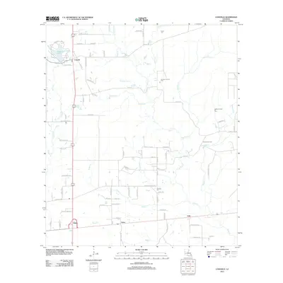
2012 Map of Longville
USGS Topo · Published 2012About this map
Longville Lake dominates the northwestern corner of this landscape, serving as a prominent landmark near the community of Longville. This region of Beauregard Parish is characterized by a dense network of watercourses and a established energy economy, as evidenced by the Hurricane Creek Oil Field, Righthand Creek Oil Field, and Clear Creek Oil Field. The settlement pattern follows both natural drainage and a grid of rural roads, connecting smaller locales like Fulton and Edith. Local history is anchored by the Frusha Cem in the north and Magnolia Cem further south. Numerous named waterways, such as Barnes Cr, Brushy Cr, and Hurricane Cr, carve through the terrain, illustrating the hydrological complexity of the area's piney woods and bayous.
Find a feature on this map
83 named features on this map. Tap any name to fly to it.
Don’t see what you’re looking for? This feature index may not catch every label — zoom into the map to look around manually.
Map Details
Editions of this 2012 Longville Map
This is the sole edition of this map. No revisions or reprints were ever made.
Other maps of this area

1935 · Gordon
USGS Topo · 1:31,680

1935 · Gaytine
USGS Topo · 1:31,680

1935 · Longville
USGS Topo · 1:31,680

1947 · Gaytine
USGS Topo · 1:31,680

1947 · Kernan
USGS Topo · 1:31,680

1947 · Reeves
USGS Topo · 1:31,680

1947 · Longville
USGS Topo · 1:31,680

1947 · Thompson Bluff
USGS Topo · 1:31,680

1947 · Bundick
USGS Topo · 1:31,680

1947 · Beckwith School
USGS Topo · 1:31,680