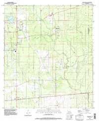
1994 Map of Longville
USGS Topo · Published 1997About this map
Longville stands as a primary hub in this southwest Louisiana landscape, where the local economy and infrastructure are shaped by natural gas and timber resources. The presence of a Natural Gas Compressor Station and multiple pipelines traversing the terrain reflects the industrial pulse of the area in the late twentieth century. Settlement patterns follow the higher ground between intricate drainage systems like Barnes Creek and Hurricane Creek, with smaller communities such as Ragley and Fulton situated near key transportation corridors. For the family historian, several locations marked simply as Cem and the hamlet of Burnett offer specific points of interest for tracing local lineages. The map also documents specialized land uses, including a Landing Strip near Longville and a Gravel Pit along Caney Creek, illustrating the intersection of private aviation and resource extraction.
Find a feature on this map
29 named features on this map. Tap any name to fly to it.
Don’t see what you’re looking for? This feature index may not catch every label — zoom into the map to look around manually.
Map Details
Editions of this 1994 Longville Map
This is the sole edition of this map. No revisions or reprints were ever made.
Other maps of this area

1935 · Gordon
USGS Topo · 1:31,680

1935 · Gaytine
USGS Topo · 1:31,680

1935 · Longville
USGS Topo · 1:31,680

1947 · Gaytine
USGS Topo · 1:31,680

1947 · Kernan
USGS Topo · 1:31,680

1947 · Reeves
USGS Topo · 1:31,680

1947 · Longville
USGS Topo · 1:31,680

1947 · Thompson Bluff
USGS Topo · 1:31,680

1947 · Bundick
USGS Topo · 1:31,680

1947 · Beckwith School
USGS Topo · 1:31,680