Loading...
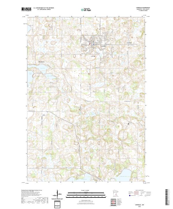
Loading map...2022 Map of Lonsdale
USGS Topo · Published 2022About this map
Lonsdale and the surrounding Rice County landscape are defined by a dense concentration of kettle lakes and agricultural townships. This 2022 survey documents the contemporary extent of the city, while also preserving the locations of smaller historic centers like Wheatland and Trondjem. The presence of Calvary Hill Cem and Saint Johns Cem provides essential touchpoints for genealogical research in this part of Minnesota.
Find a feature on this map
87 named features on this map. Tap any name to fly to it.
Don’t see what you’re looking for? This feature index may not catch every label — zoom into the map to look around manually.
Map Details
Date Portrayed2022
Date Published2022
PublisherU.S. Geological Survey
Map TypeTopographic
Scale1:24000
Physical Dimensions24 x 29 inches
Editions of this 2022 Lonsdale Map
This is the sole edition of this map. No revisions or reprints were ever made.
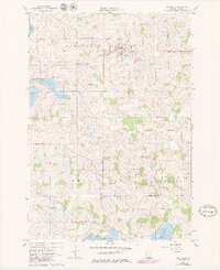
Historical Maps of Trondjem Through Time
Featured Locations
Source Details
SourceU.S. Geological Survey
CopyrightPublic Domain