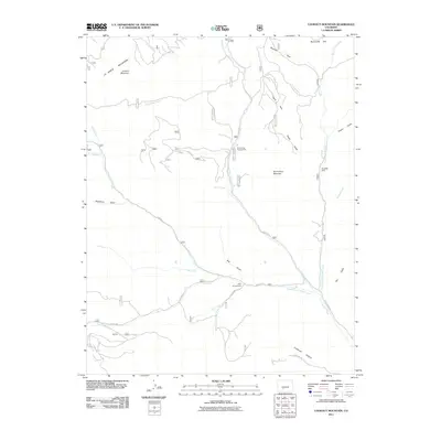
2011 Map of Lookout Mountain
USGS Topo · Published 2011About this map
The high peaks and drainages of the La Garita Mountains define this section of Saguache County, dominated by the prominent elevations of Lookout Mountain and Storm King Mountain. The landscape is a network of alpine parks and watercourses, where the Middle Fork Carnero Creek and South Fork Carnero Creek converge as they flow eastward. These canyons and meadows have long served as seasonal corridors through the high country, evidenced by established recreation sites like Storm King Campground and Poso Campground. Traces of water management and high-altitude land use are visible at Paradise Dam on the North Fork Carnero Creek. From the deep recesses of Coolbroth Canyon to the open flats of Mexican Park and Royal Park, the map captures a remote backcountry environment shaped by its complex hydrology and the winding paths of roads like Co RD M 33.
Find a feature on this map
36 named features on this map. Tap any name to fly to it.
Don’t see what you’re looking for? This feature index may not catch every label — zoom into the map to look around manually.
Map Details
Editions of this 2011 Lookout Mountain Map
This is the sole edition of this map. No revisions or reprints were ever made.
Other maps of this area

1914 · Creede
USGS Topo · 1:125,000

1915 · Del Norte
USGS Topo · 1:125,000

1916 · Creede
USGS Topo · 1:125,000

1917 · Del Norte
USGS Topo · 1:125,000

1945 · Durango
USGS Topo · 1:250,000

1953 · Durango
USGS Topo · 1:250,000

1954 · Durango
USGS Topo · 1:250,000

1956 · Montrose
USGS Topo · 1:250,000

1959 · Montrose
USGS Topo · 1:250,000

1960 · Montrose
USGS Topo · 1:250,000