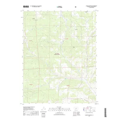
2019 Map of Lookout Mountain
USGS Topo · Published 2019About this map
Rio Grande National Forest encompasses this high-altitude landscape in the La Garita Mountains, defined by a network of drainage systems and isolated peaks. Lookout Mtn and Storm King Mtn stand as primary landmarks above the dissected terrain of Royal Park and Mexican Park. The hydrology of the area is dominated by the upper reaches of the Carnero Cr system, including the N Fork Carnero Cr, Middle Fork Carnero Cr, and S Fork Carnero Cr. This 2019 survey documents a landscape of steep gulches and canyons, such as Raspberry Gulch and Coolbroth Canyon, where early transit is represented by surviving county roads like Co RD 41 G. The map serves as a detailed record of high mountain parks and water sources that have long guided movement through this portion of Saguache County.
Find a feature on this map
32 named features on this map. Tap any name to fly to it.
Don’t see what you’re looking for? This feature index may not catch every label — zoom into the map to look around manually.
Map Details
Editions of this 2019 Lookout Mountain Map
This is the sole edition of this map. No revisions or reprints were ever made.
Other maps of this area

1914 · Creede
USGS Topo · 1:125,000

1915 · Del Norte
USGS Topo · 1:125,000

1916 · Creede
USGS Topo · 1:125,000

1917 · Del Norte
USGS Topo · 1:125,000

1945 · Durango
USGS Topo · 1:250,000

1953 · Durango
USGS Topo · 1:250,000

1954 · Durango
USGS Topo · 1:250,000

1956 · Montrose
USGS Topo · 1:250,000

1959 · Montrose
USGS Topo · 1:250,000

1960 · Montrose
USGS Topo · 1:250,000