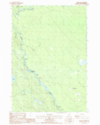
1988 Map of Loon Bay
USGS Topo · Published 1988About this map
The St Croix River serves as the international boundary between Maine and New Brunswick in this late 1980s topographical survey. The landscape is defined by the river's descent through a series of navigational hazards, including Rocky Rips, Split Rock Rips, and the notably named Meetinghouse Rips. These features, along with Canoose Ledge, illustrate the river's transition from the broad waters of Loon Bay into more turbulent passages.
Find a feature on this map
38 named features on this map. Tap any name to fly to it.
Don’t see what you’re looking for? This feature index may not catch every label — zoom into the map to look around manually.
Map Details
Editions of this 1988 Loon Bay Map
This is the sole edition of this map. No revisions or reprints were ever made.
Other maps of this area

1930 · Vanceboro
USGS Topo · 1:48,000

1933 · Vanceboro
USGS Topo · 1:62,500

1940 · Waite
USGS Topo · 1:62,500

1940 · Forest
USGS Topo · 1:62,500

1940 · Kellyland
USGS Topo · 1:62,500

1942 · Kellyland
USGS Topo · 1:62,500

1942 · Waite
USGS Topo · 1:62,500

1942 · Forest
USGS Topo · 1:62,500

1957 · Fredericton
USGS Topo · 1:250,000

1963 · Fredericton
USGS Topo · 1:250,000