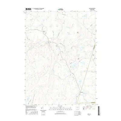
2016 Map of Lopez
USGS Topo · Published 2016About this map
Lopez sits as the central hub of this Sullivan County landscape, where the waters of Loyalsock Cr and its many tributaries wind through high plateau country. The settlement pattern here is sparse but historically significant, featuring the small hamlets of Murray to the northwest and Ricketts at the southern edge. The area is defined by its complex hydrology, with numerous marshlands and water bodies such as Half Moon Swamp, Flag Marsh, and Pine Marsh dotting the high ground between Indian Ridge and Dutch Mtn. Local history and genealogy interests are anchored by sites like Saint Vladimirs Cem and the uniquely named Junk Cem near the eastern border. The network of local roads, including White Ash Rd and Dutch Mountain Rd, traces the geography of a region shaped by its upland bogs and isolated creek valleys.
Find a feature on this map
81 named features on this map. Tap any name to fly to it.
Don’t see what you’re looking for? This feature index may not catch every label — zoom into the map to look around manually.
Map Details
Editions of this 2016 Lopez Map
This is the sole edition of this map. No revisions or reprints were ever made.
Other maps of this area

1891 · Harveys Lake
USGS Topo · 1:62,500

1893 · Harvey Lake
USGS Topo · 1:62,500

1934 · Laporte
USGS Topo · 1:62,500

1943 · Monroeton
USGS Topo · 1:62,500

1945 · Meshoppen
USGS Topo · 1:62,500

1945 · Jenningsville
USGS Topo · 1:24,000

1946 · Dutch Mtn
USGS Topo · 1:24,000

1946 · Sweet Valley
USGS Topo · 1:24,000

1947 · Jenningsville
USGS Topo · 1:31,680
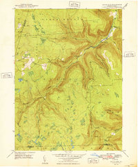
1948 · Dutch Mtn
USGS Topo · 1:24,000
Featured Places
- Colley Township, PA
- Forkston Township, PA
- Laporte Township, PA
- Lopez, Colley Township
- Ricketts, Colley Township