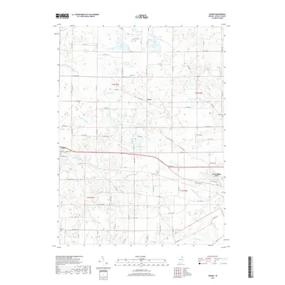
2019 Map of Lorane
USGS Topo · Published 2019About this map
Columbia City occupies the southeastern corner of this Whitley County landscape, where the outskirts of the city meet a dense network of agricultural ditches and small lakes. The terrain is defined by its glacial history, featuring a scattering of water bodies such as Troy Cedar Lake, Goose Lake, and Indian Lake. These lakes are connected by an extensive drainage system including Schuman Ditch and Maynard Ditch, illustrating the mid-century transformation of the northern Indiana wetlands into productive farmland.
Find a feature on this map
104 named features on this map. Tap any name to fly to it.
Don’t see what you’re looking for? This feature index may not catch every label — zoom into the map to look around manually.
Map Details
Editions of this 2019 Lorane Map
This is the sole edition of this map. No revisions or reprints were ever made.
Other maps of this area

1950 · Pierceton
USGS Topo · 1:24,000

1950 · North Webster
USGS Topo · 1:24,000

1951 · Ormas
USGS Topo · 1:24,000

1951 · Merriam
USGS Topo · 1:24,000

1953 · Fort Wayne
USGS Topo · 1:250,000

1955 · Columbia City
USGS Topo · 1:24,000

1956 · Fort Wayne
USGS Topo · 1:250,000

1956 · Lorane
USGS Topo · 1:24,000
1961 · Laud
USGS Topo · 1:24,000
1962 · South Whitley West
USGS Topo · 1:24,000