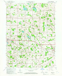
1965 Map of Lorane
USGS Topo · Published 1966About this map
Glacial lakes and small agricultural settlements define this portion of Whitley County in the mid-1960s. Larwill serves as a primary hub along the Pennsylvania railroad line, while the unincorporated community of Lorane sits further north along the Old Trail. The landscape is densely packed with water bodies like Troy Cedar Lake, Goose Lake, and Wilson Lake, many of which supported local industry and recreation, evidenced by the Ice House Lake and Camp Whitley.
Find a feature on this map
54 named features on this map. Tap any name to fly to it.
Don’t see what you’re looking for? This feature index may not catch every label — zoom into the map to look around manually.
Map Details
Editions of this 1965 Lorane Map
This is the sole edition of this map. No revisions or reprints were ever made.
Other maps of this area

1950 · Pierceton
USGS Topo · 1:24,000

1950 · North Webster
USGS Topo · 1:24,000

1951 · Ormas
USGS Topo · 1:24,000

1951 · Merriam
USGS Topo · 1:24,000

1953 · Fort Wayne
USGS Topo · 1:250,000

1955 · Columbia City
USGS Topo · 1:24,000

1956 · Fort Wayne
USGS Topo · 1:250,000

1956 · Lorane
USGS Topo · 1:24,000
1961 · Laud
USGS Topo · 1:24,000
1962 · South Whitley West
USGS Topo · 1:24,000