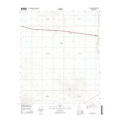
2014 Map of Lost Horse Peak
USGS Topo · Published 2014About this map
Freeman sits at the northern edge of this arid Sonoran landscape, positioned along a major east-west transportation corridor that bisects the desert terrain. To the south, the topography rises into the White Hills and reaches a prominent point at Lost Horse Peak. The map documents a critical water management system necessary for life and travel in this environment, featuring named reservoirs such as Lost Horse Tank, Ormall Tank, and White Tank. These features, along with the drainage of Vekol Wash on the eastern boundary, highlight the reliance on seasonal water sources in Maricopa County. The intersection of modern infrastructure, represented by S Freeman Rd and S Vekol Rd, with these traditional desert landmarks illustrates the ongoing human presence in this sparsely populated region.
Find a feature on this map
15 named features on this map. Tap any name to fly to it.
Don’t see what you’re looking for? This feature index may not catch every label — zoom into the map to look around manually.
Map Details
Editions of this 2014 Lost Horse Peak Map
This is the sole edition of this map. No revisions or reprints were ever made.
Other maps of this area

1941 · Vekol Mountains
USGS Topo · 1:62,500

1942 · Vekol Mountains
USGS Topo · 1:62,500

1946 · Antelope Peak
USGS Topo · 1:62,500

1948 · Antelope Peak
USGS Topo · 1:62,500

1951 · Estrella
USGS Topo · 1:62,500

1953 · Ajo
USGS Topo · 1:250,000

1957 · Ajo
USGS Topo · 1:250,000

1958 · Ajo
USGS Topo · 1:250,000

1958 · Kaka
USGS Topo · 1:62,500

1962 · Ajo
USGS Topo · 1:250,000