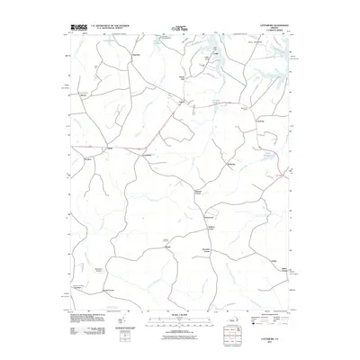
2011 Map of Lottsburg
USGS Topo · Published 2011About this map
Gardy Millpond and Courtney Millpond anchor the northern reaches of this landscape in the Northern Neck of Virginia, where a network of tidal creeks and millponds defines the local geography. The area is dotted with numerous small settlements and family-named corners such as Walkers Corner and Mount Zion Corner, reflecting a long-standing pattern of dispersed rural communities. Coastal access is marked by points like Lodge Landing and the peninsula of Cherry Point Neck, which reaches into the surrounding waterways. Genealogists will find significant value in the documentation of local burial grounds, including Gibeon Cemetery, Oakland Cemetery, and Farnham Cemetery. The map also captures several historic water-driven sites like Headleys Millpond and Fallins Millpond, illustrating the historical importance of milling to the region's agricultural economy.
Find a feature on this map
59 named features on this map. Tap any name to fly to it.
Don’t see what you’re looking for? This feature index may not catch every label — zoom into the map to look around manually.
Map Details
Editions of this 2011 Lottsburg Map
This is the sole edition of this map. No revisions or reprints were ever made.
Other maps of this area

1892 · Piney Point
USGS Topo · 1:62,500

1894 · Piney Point
USGS Topo · 1:62,500

1894 · Point Lookout
USGS Topo · 1:62,500

1895 · Nomini
USGS Topo · 1:125,000

1895 · Piney Point
USGS Topo · 1:62,500

1898 · Nomini
USGS Topo · 1:125,000

1898 · St. Marys
USGS Topo · 1:125,000

1901 · Piney Point
USGS Topo · 1:62,500

1906 · St. Marys
USGS Topo · 1:125,000

1912 · Point Lookout
USGS Topo · 1:62,500