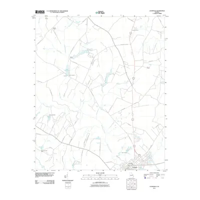
2011 Map of Louisville
USGS Topo · Published 2011About this map
Louisville serves as the focal point of this Jefferson County survey, situated at the confluence of several key regional roads and the drainage systems of Rocky Comfort Creek and the Manson Branch. The landscape is defined by its agrarian and water-dependent history, evidenced by the numerous mill and lake features such as Clarks Mill on Clarks Mill Pond and Davis Lake, which is secured by the Davis Lake Dam. Genealogists will find a wealth of local burial sites, including the Little Cemetery, Bothwell Cemetery, and Duhart Cemetery, which are scattered among the rural stretches north of the town center. The road network, featuring names like Duhart Church Rd and Mennonite Church Rd, suggests a long-standing community structure built around local congregations and family lands. Waterways like Duhart Creek and Cason Branch wind through the territory, feeding into the larger lakes that characterize this part of Georgia.
Find a feature on this map
59 named features on this map. Tap any name to fly to it.
Don’t see what you’re looking for? This feature index may not catch every label — zoom into the map to look around manually.
Map Details
Editions of this 2011 Louisville Map
This is the sole edition of this map. No revisions or reprints were ever made.
Other maps of this area

1920 · Stapleton
USGS Topo · 1:62,500

1948 · Stapleton
USGS Topo · 1:62,500

1948 · Louisville
USGS Topo · 1:24,000

1950 · Louisville
USGS Topo · 1:24,000

1950 · Wrens
USGS Topo · 1:24,000

1950 · Matthews
USGS Topo · 1:24,000

1950 · Kellys Pond
USGS Topo · 1:24,000

1953 · Athens
USGS Topo · 1:250,000

1957 · Macon
USGS Topo · 1:250,000

1958 · Macon
USGS Topo · 1:250,000