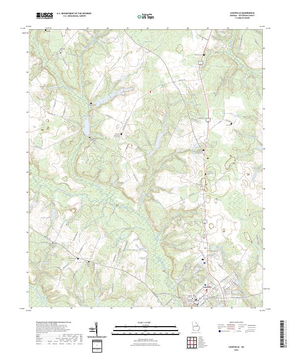
2024 Map of Louisville
USGS Topo · Published 2024About this map
Louisville stands at the heart of this East Georgia landscape, where the Ogeechee River and Rocky Comfort Creek converge. The town's historical depth is evident in the concentration of burial grounds and religious sites, ranging from the central Louisville City Cem and Battey-Heard Cem to the outlying Pine Hill Baptist Church Cem. The surrounding countryside is defined by a network of small waterways like Duhart Creek and Cason Branch, which historically supported local industry as seen at Clarks Mill Pond.
Find a feature on this map
90 named features on this map. Tap any name to fly to it.
Don’t see what you’re looking for? This feature index may not catch every label — zoom into the map to look around manually.
Map Details
Editions of this 2024 Louisville Map
This is the sole edition of this map. No revisions or reprints were ever made.
Other maps of this area

1920 · Stapleton
USGS Topo · 1:62,500

1948 · Stapleton
USGS Topo · 1:62,500

1948 · Louisville
USGS Topo · 1:24,000

1950 · Louisville
USGS Topo · 1:24,000

1950 · Wrens
USGS Topo · 1:24,000

1950 · Matthews
USGS Topo · 1:24,000

1950 · Kellys Pond
USGS Topo · 1:24,000

1953 · Athens
USGS Topo · 1:250,000

1957 · Macon
USGS Topo · 1:250,000

1958 · Macon
USGS Topo · 1:250,000