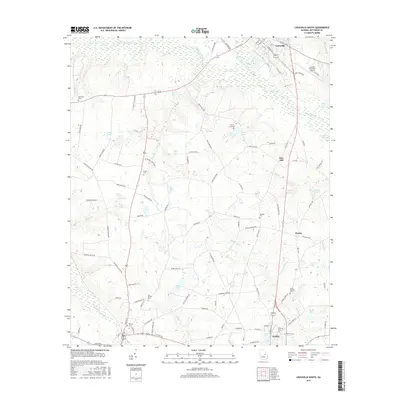
2017 Map of Louisville South
USGS Topo · Published 2017About this map
The Ogeechee River and Rocky Comfort Creek define the northern landscape of this Jefferson County survey, which covers the area from Louisville south toward Wadley. The terrain is marked by a complex network of wetlands and water bodies, including Smith Lake, Cobb Lake, and Weeks Lake, alongside several family-named landmarks such as Parker Cem and Plunkett Cem. Evidence of rural settlement patterns appears through scattered clusters like Moxley and Pine Hill, connected by historic routes such as Old US Hwy 1. The map reveals the relationship between the area's many waterways, like Boggy Gut Cr and Williamson Swamp Cr, and the positioning of local infrastructure, including the Louisville Municipal Airport. Genealogy researchers will find significant value in the distribution of numerous community burial sites, including Old Bethel Cem and Ebenezer Cem.
Find a feature on this map
102 named features on this map. Tap any name to fly to it.
Don’t see what you’re looking for? This feature index may not catch every label — zoom into the map to look around manually.
Map Details
Editions of this 2017 Louisville South Map
This is the sole edition of this map. No revisions or reprints were ever made.
Other maps of this area

1920 · Stapleton
USGS Topo · 1:62,500

1948 · Stapleton
USGS Topo · 1:62,500

1948 · Louisville
USGS Topo · 1:24,000

1950 · Louisville
USGS Topo · 1:24,000

1950 · Kellys Pond
USGS Topo · 1:24,000

1953 · Athens
USGS Topo · 1:250,000

1957 · Macon
USGS Topo · 1:250,000

1958 · Macon
USGS Topo · 1:250,000

1958 · Athens
USGS Topo · 1:250,000

1959 · Athens
USGS Topo · 1:250,000