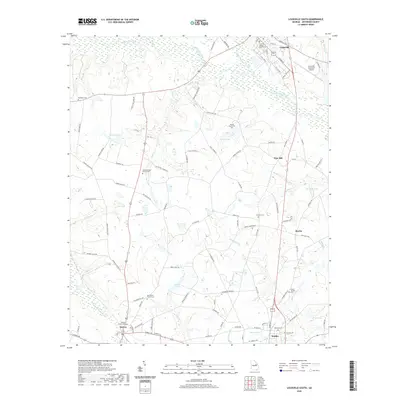
2020 Map of Louisville South
USGS Topo · Published 2020About this map
The Ogeechee River and Rocky Comfort Creek converge near Louisville, the historic seat of Jefferson County. This landscape is defined by its transition from the structured street grid of Louisville down toward the smaller crossroads of Pine Hill, Moxley, and Wadley. Genealogists will find a high density of burial sites throughout the rural acreage, including the Old Bethel Church Cem, Parkers Chapel Cem, and Pierce Grove Cem. The area’s hydrology is particularly complex, with numerous named branches and lakes like Kelly Lake and Thomas Lake scattered among the wetlands of Whites Cr and Boggy Gut Cr. Toward the south, the settlement of Bartow is anchored by the Bartow Church, while the Louisville Municipal Airport and the Jefferson County Courthouse remain central landmarks for the region's administrative and logistical operations.
Find a feature on this map
106 named features on this map. Tap any name to fly to it.
Don’t see what you’re looking for? This feature index may not catch every label — zoom into the map to look around manually.
Map Details
Editions of this 2020 Louisville South Map
This is the sole edition of this map. No revisions or reprints were ever made.
Other maps of this area

1920 · Stapleton
USGS Topo · 1:62,500

1948 · Stapleton
USGS Topo · 1:62,500

1948 · Louisville
USGS Topo · 1:24,000

1950 · Louisville
USGS Topo · 1:24,000

1950 · Kellys Pond
USGS Topo · 1:24,000

1953 · Athens
USGS Topo · 1:250,000

1957 · Macon
USGS Topo · 1:250,000

1958 · Macon
USGS Topo · 1:250,000

1958 · Athens
USGS Topo · 1:250,000

1959 · Athens
USGS Topo · 1:250,000