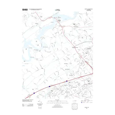
2013 Map of Lovell
USGS Topo · Published 2013About this map
Melton Hill Lake defines the northern and western margins of this Knox County landscape, where the waters of the Clinch River wrap around Freels Bend and Williams Bend. This 2013 survey illustrates the dense residential expansion of the Knoxville suburbs, with numerous subdivisions like Woodland Trace, Hickory Woods, and Wexford Downs filling the spaces between established rural landmarks. The University of Tennessee Arboretum occupies a significant tract in the northwest, adjacent to the Scarboro community and the secure perimeter of the US AEC Oak Ridge Area. Traditional gathering points such as Byrd Chapel and Robinson Crossroads persist amidst a modernized transportation network of interstate ramps and state routes. Along the river, historical river features like Sneaking Island Shoals and Gallahers Shoals remain noted even as the lake has altered the original river channel.
Find a feature on this map
298 named features on this map. Tap any name to fly to it.
Don’t see what you’re looking for? This feature index may not catch every label — zoom into the map to look around manually.
Map Details
Editions of this 2013 Lovell Map
This is the sole edition of this map. No revisions or reprints were ever made.
Other maps of this area

1893 · Briceville
USGS Topo · 1:125,000

1895 · Loudon
USGS Topo · 1:125,000

1895 · Briceville
USGS Topo · 1:125,000

1896 · Briceville
USGS Topo · 1:125,000

1935 · Lenoir City
USGS Topo · 1:24,000

1935 · Bethel Valley
USGS Topo · 1:24,000

1935 · Bearden
USGS Topo · 1:24,000

1935 · Lovell
USGS Topo · 1:24,000

1936 · Louisville
USGS Topo · 1:24,000

1936 · Windrock
USGS Topo · 1:24,000