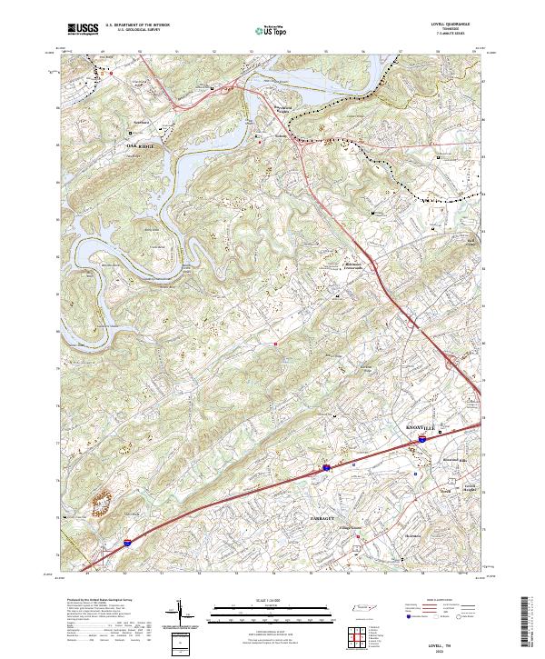
2022 Map of Lovell
USGS Topo · Published 2022About this map
Chestnut Ridge and Beaver Ridge define the northeast-to-southwest orientation of this Knox County landscape, where the Clinch River carves through the ridges near Solway. The map captures a complex mix of mid-century industrial legacy and modern suburban expansion, with the edges of Oak Ridge appearing to the northwest and the northern reaches of Farragut and Knoxville establishing a dense residential presence in the south. Between these hubs, the Hardin Valley retains a distinct character, anchored by the Pellissippi State Technical Community College and several longstanding local landmarks.
Find a feature on this map
68 named features on this map. Tap any name to fly to it.
Don’t see what you’re looking for? This feature index may not catch every label — zoom into the map to look around manually.
Map Details
Editions of this 2022 Lovell Map
This is the sole edition of this map. No revisions or reprints were ever made.
Other maps of this area

1893 · Briceville
USGS Topo · 1:125,000

1895 · Loudon
USGS Topo · 1:125,000

1895 · Briceville
USGS Topo · 1:125,000

1896 · Briceville
USGS Topo · 1:125,000

1935 · Lenoir City
USGS Topo · 1:24,000

1935 · Bethel Valley
USGS Topo · 1:24,000

1935 · Bearden
USGS Topo · 1:24,000

1935 · Lovell
USGS Topo · 1:24,000

1936 · Louisville
USGS Topo · 1:24,000

1936 · Windrock
USGS Topo · 1:24,000