
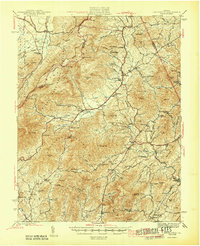
1946 Map of Lovingston
USGS Topo · Published 1946About this map
Lovingston serves as the focal point for this mid-century study of the Nelson County landscape, where the Blue Ridge Mountains meet the rolling foothills of central Virginia. The terrain is dominated by the George Washington National Forest, with the recently established Blue Ridge Parkway and the Appalachian Trail tracing the high ridges along the western boundary. A dense network of schools and churches, such as the Rockfish Valley High Sch and Mt Zion Ch, indicates a well-established rural community organized around the gaps and hollows of the mountains.
Find a feature on this map
105 named features on this map. Tap any name to fly to it.
Don’t see what you’re looking for? This feature index may not catch every label — zoom into the map to look around manually.
Map Details
Editions of this 1946 Lovingston Map
2 editions found
Other maps of this area

1892 · Buckingham
USGS Topo · 1:125,000

1892 · Harrisonburg
USGS Topo · 1:125,000

1894 · Staunton
USGS Topo · 1:125,000

1894 · Lexington
USGS Topo · 1:125,000

1929 · Covesville
USGS Topo · 1:62,500

1931 · University
USGS Topo · 1:62,500

1934 · Waynesboro
USGS Topo · 1:48,000

1935 · Amherst
USGS Topo · 1:48,000

1935 · Covesville
USGS Topo · 1:62,500

1935 · University
USGS Topo · 1:62,500