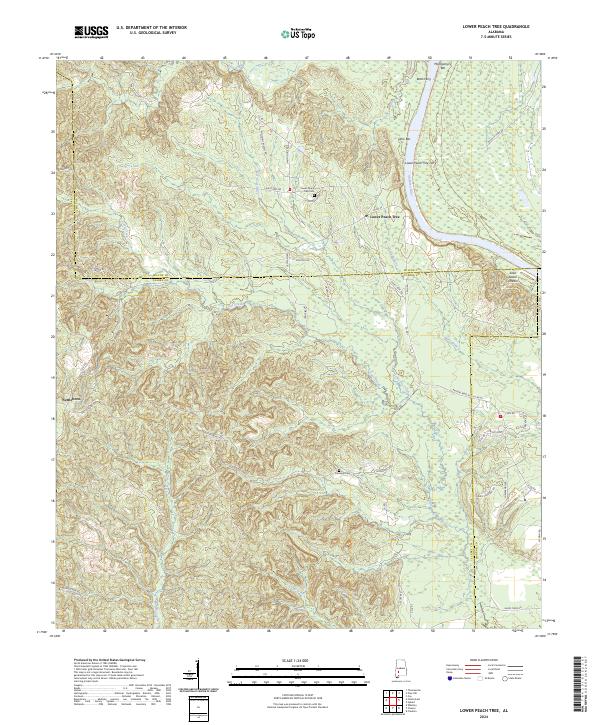
2024 Map of Lower Peach Tree
USGS Topo · Published 2024About this map
The Alabama River defines the landscape of this Clarke and Wilcox County region, carving a wide path where historic river crossings like Botts Ferry and Lower Peach Tree Ferry once facilitated commerce and travel. The settlement of Lower Peach Tree serves as a local focal point near the river's edge, supported by landmarks such as the Lower Peach Tree Cem and topographical features like Ohio Bar and Montgomery Bar.
Find a feature on this map
58 named features on this map. Tap any name to fly to it.
Don’t see what you’re looking for? This feature index may not catch every label — zoom into the map to look around manually.
Map Details
Editions of this 2024 Lower Peach Tree Map
This is the sole edition of this map. No revisions or reprints were ever made.
Other maps of this area

1953 · Andalusia
USGS Topo · 1:250,000

1957 · Andalusia
USGS Topo · 1:250,000

1972 · Franklin
USGS Topo · 1:24,000

1972 · Whatley
USGS Topo · 1:24,000

1972 · Chance
USGS Topo · 1:24,000

1973 · Coy
USGS Topo · 1:24,000

1973 · Fulton East
USGS Topo · 1:24,000

1973 · Hybart
USGS Topo · 1:24,000

1973 · Pine Hill
USGS Topo · 1:24,000

1973 · Thomasville
USGS Topo · 1:24,000