Old Maps of Clarke County, Alabama
Explore 192 old maps of Clarke County, spanning from 1943 to today. These high-resolution historic maps reveal how streets, neighborhoods, landmarks, and natural features evolved over time — perfect for genealogy, metal detecting, research, and local history exploration.
What you can do with these maps:
- See how Clarke County changed over time: Compare historical maps to modern-day views to trace roads, homesites, rail lines & more.
- View detailed metadata: Each map includes creators, publishers, year, scale, and archive source.
- Overlay maps with satellite & LiDAR: Visualize the past alongside modern tools to explore terrain & human change.
- Trusted historical sources: Maps sourced from the USGS, Library of Congress, and other archives.
- Access maps your way: View online, download high-res files, or order prints for personal or research use.
Start exploring old maps of Clarke County to uncover forgotten places, hidden landmarks, and the deep history beneath your feet.
Clarke County, AL maps
(192)- 1943 Map of Choctaw Bluff, 1958 Print
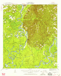 1943 Choctaw Bluff1958 Print · USGSSouthwestern Alabama during the 1940s is shaped by the meeting of the Tombigbee River and Alabama River. Researchers can trace old river landings like Dixie Ldg and find the historic Grave of Red Eagle (Weatherford).2 unique versions available
 - 1943 Map of Tensaw, 1958 Print
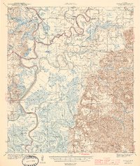
 1943 Tensaw1958 Print · USGSBaldwin County at the height of the river-landing era is detailed here through its complex bayous and plantations. Genealogists can locate family names at Lancaster Cem and trace rural life at Fleming Sch or Davis Ldg.2 unique versions available
 - 1944 Map of Tensaw
 1944 Tensaw1944 Print · USGSThe Alabama and Mobile River deltas are captured here during the mid-forties, showing a landscape defined by intricate waterways and rural landings. Researchers can trace historic river access at Old Ft Stoddard Mt Vernon Ldg or locate family sites like Lancaster Cem and Stockton Sch.3 unique versions available
 - 1946 Map of Choctaw Bluff
 1946 Choctaw Bluff1946 Print · USGSThe river-bottom country of southwest Alabama is shown here just after the war, where the mighty Tombigbee and Alabama rivers meet. Researchers can trace historic river landings like Oven Bluff or find the Grave of Red Eagle (Weatherford) near the confluence.2 unique versions available
 - 1953 Map of Andalusia, 1965 Print
 1953 Andalusia1965 Print · USGSSouth Alabama in the mid-twentieth century remains a land of pine forests and river-fed settlements. You can trace the vital rail corridors of the Louisville & Nashville and locate regional centers such as Andalusia, Brewton, and Monroeville.3 unique versions available
 - 1953 Map of Hattiesburg, 1965 Print
 1953 Hattiesburg1965 Print · USGSSouth Mississippi and western Alabama are shown here during the mid-twentieth century as the timber and rail industries shaped the region. Genealogists and historians can trace rail lines like the Mississippi Central and locate rural centers such as Magee, Richton, and Mount Vernon.4 unique versions available
 - 1957 Map of Andalusia
 1957 Andalusia1957 Print · USGSSouthern Alabama in the mid-1950s was a landscape defined by timbered stretches and the rhythmic flow of the Alabama River. Researchers can trace the legacy of the rail era through the Central of Georgia tracks and the storied river bluffs at Choctaw Bluff.
 - 1958 Map of Hattiesburg
 1958 Hattiesburg1958 Print · USGSSoutheastern Mississippi's timber and rail networks are at their peak during the late fifties, centered on the growing hubs of Hattiesburg and Laurel. Researchers can trace old family landmarks like Sims Chapel, the Busbey Game Refuge, and the vanished stops along the Mississippi Central railroad.2 unique versions available
 - 1971 Map of Coffeeville, 1974 Print
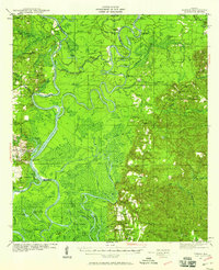
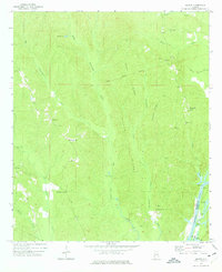
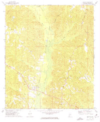
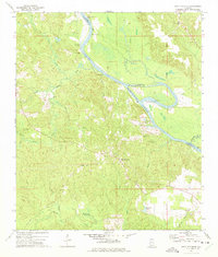
 1971 Coffeeville1974 Print · USGSThe Tombigbee River country of Clarke County is shown here in the early 1970s, before modern infrastructure reshaped many rural Alabamian river towns. Researchers can trace family sites near Coffeeville, explore the crossroads at Center Point, and locate landmarks like Jones Chapel and the High Sch.2 unique versions available
 - 1971 Map of Ararat, 1975 Print
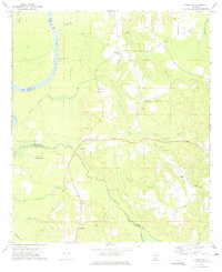
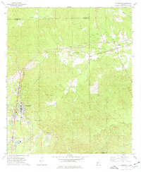
 1971 Ararat1975 Print · USGSChoctaw County in the early 1970s is shown here as a landscape of timbered ridges and river bottomlands. Genealogists and local historians can trace the sites of Slaters Chapel, Thornton Springs, and the Old Indian Treaty Boundary near the river.2 unique versions available
 - 1971 Map of Coffeeville Lock And Dam, 1975 Print
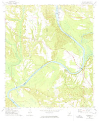
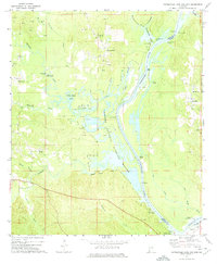 1971 Coffeeville Lock And Dam1975 Print · USGSThe Tombigbee River corridor was undergoing significant change in the 1970s as industrial oil extraction operated alongside new conservation efforts. Researchers can trace river landings like Sellers Landing and find local landmarks such as Pleasant Chapel and Womack Hill.2 unique versions available
 - 1972 Map of Chrysler, 1974 Print
 1972 Chrysler1974 Print · USGSMonroe County and the Baldwin county line are mapped here in the early seventies as the river-and-rail landscape was shifting. Genealogists and local historians can locate several family-named landmarks and rural centers, including Eliska, Mamies Chapel, and Shomo Cem.2 unique versions available
 - 1972 Map of Flynns Lake, 1974 Print
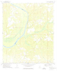 1972 Flynns Lake1974 Print · USGSThe Alabama River corridor at the Monroe and Clarke county line comes to life in this early 1970s survey. Genealogists and researchers can trace historic river access at Dale Ferry Landing and locate rural landmarks like Mt Gilead Ch and Baileys.2 unique versions available
 - 1972 Map of Whatley, 1975 Print
 1972 Whatley1975 Print · USGSClarke County's rural landscape is captured here in the early seventies, centered on the railroad community of Whatley. Researchers can trace family history at sites like Orange Hill Ch or locate the path of the Old Indian Treaty Boundary.
 - 1972 Map of Gainestown, 1975 Print
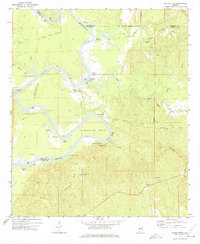
 1972 Gainestown1975 Print · USGSThe Alabama River dominates this southwest Alabama landscape in the early seventies, where river landings still defined local commerce. Genealogists can trace family roots through sites like Gainestown, Barlow Bend, and the Good Hope Ch Cem.
 - 1972 Map of Claiborne, 1975 Print
 1972 Claiborne1975 Print · USGSThe Alabama River corridor in the early 1970s reveals a landscape of historic landings and modern engineering. Trace family roots and riverside industry at Gosport Landing, McConnico Cem, and the massive Claiborne Lock and Dam.
 - 1972 Map of Tattlersville, 1975 Print
 1972 Tattlersville1975 Print · USGSThe Tombigbee River corridor in southwestern Alabama was defined by its water-bound commerce and quiet rural crossroads in the early 1970s. Genealogists can trace family names at Blount Landing and rural congregations at New Hope Ch or St Pauls Ch.2 unique versions available
 - 1972 Map of Woods Bluff, 1975 Print
 1972 Woods Bluff1975 Print · USGSThe Tombigbee River country at the start of the 1970s reveals a landscape of historic river landings and ancient boundaries. Researchers can trace family sites near Smyer and Woods Bluff, or locate the Old Indian Treaty Boundary and Witch Creek Ch.2 unique versions available
 - 1972 Map of Suggsville, 1975 Print
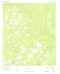
 1972 Suggsville1975 Print · USGSClarke County's rural interior is documented here during the early seventies, centered on the historic crossroads of Suggsville. Researchers can trace the Old Indian Treaty Boundary and locate family landmarks like Poyner Chapel Cem and the Southern rail stop at Allen.
 - 1972 Map of Chance, 1975 Print
 1972 Chance1975 Print · USGSThe rural riverlands of Clarke and Monroe Counties are captured here in the early seventies, centered on the Alabama River corridor. Researchers can trace local heritage through landmarks like Finchburg, Fellowship Ch, and Foster Landing.
 - 1972 Map of St. Stephens, 1975 Print
 1972 St. Stephens1975 Print · USGSThe Tombigbee River corridor at the Washington and Clarke county line comes to life in this early 1970s survey. Researchers can trace historic river navigation at Old Lock No 1 or locate family plots at Old St Stephens Cem and Granade Cem.2 unique versions available
 - 1973 Map of Fulton East, 1977 Print
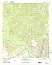
 1973 Fulton East1977 Print · USGSClarke County's rural timber and rail lands are shown here in the early seventies as the SOUTHERN railroad connected small communities. Genealogists and local historians can locate Henley Cem, Salem Ch Cem, and the historic OLD INDIAN TREATY BDY.
 - 1973 Map of Thomasville, 1977 Print
 1973 Thomasville1977 Print · USGSThomasville and its surrounding rail-side communities are captured here in the early 1970s as the town expanded near the SOUTHERN line. Genealogists and historians can trace family roots through numerous sites like Finley Crossing, Danzy Cem, and the historic Old Indian Treaty Bdy.2 unique versions available
 - 1973 Map of Lower Peach Tree, 1977 Print
 1973 Lower Peach Tree1977 Print · USGSThe Alabama River corridor near Lower Peach Tree is captured here during the 1970s as the river system adapted to the creation of Claiborne Lake. Genealogists can locate family landmarks like New Mt Moriah Ch, Kennedy Cem, and the historic Indian Treaty Bdy.
 - 1978 Map of Jackson, 1979 Print
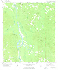
 1978 Jackson1979 Print · USGSJackson and the Tombigbee River corridor are captured in the late seventies as a busy center of river-and-rail commerce. Researchers can trace family roots at Peniel Cem or explore early schooling at Gillmore Sch and Jackson Academy.2 unique versions available
Showing maps 1-25 of 192
Top cities of Clarke County
- Jackson historical maps
- Thomasville historical maps
- Grove Hill historical maps
- Coffeeville historical maps
- Fulton historical maps
Frequently asked questions
- What are the different types of historical maps available for Clarke County?
- What is the oldest map of Clarke County?
- Where can I purchase historical maps of Clarke County for my home or office?
- Where can I download high-res historical maps of Clarke County?
- Are there historical topographic maps available for Clarke County?
- Is there historical aerial imagery available for Clarke County?
- Where are historical maps of Clarke County sourced from?