
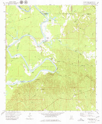
1972 Map of Woods Bluff
USGS Topo · Published 1975About this map
The Tombigbee River snakes through the borderlands of Clarke, Marengo, and Choctaw Counties, carving the deep arc of Cunningham Bend. This 1970s landscape is defined by its relationship to the water, where numerous landings like McCartys Landing and Wildcat Landing punctuate the riverbanks alongside prominent overlooks such as Whites Bluff and Davis Bluff. The area's history is physically etched into the terrain by the Old Indian Treaty Boundary, which runs west-to-east across the northern section of the map.
Find a feature on this map
50 named features on this map. Tap any name to fly to it.
Don’t see what you’re looking for? This feature index may not catch every label — zoom into the map to look around manually.
Map Details
Editions of this 1972 Woods Bluff Map
2 editions found
Other maps of this area

1953 · Montgomery
USGS Topo · 1:250,000

1953 · Andalusia
USGS Topo · 1:250,000

1953 · Hattiesburg
USGS Topo · 1:250,000

1953 · Meridian
USGS Topo · 1:250,000

1956 · Montgomery
USGS Topo · 1:250,000

1957 · Meridian
USGS Topo · 1:250,000

1957 · Montgomery
USGS Topo · 1:250,000

1957 · Andalusia
USGS Topo · 1:250,000

1958 · Hattiesburg
USGS Topo · 1:250,000

1965 · Meridian
USGS Topo · 1:250,000