
1953 Map of Meridian
USGS Topo · Published 1966About this map
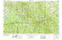
The city of Meridian anchors this mid-century look at East Central Mississippi and Western Alabama, serving as a vital transportation hub where the Meridian & Bigbee Railroad and the Southern Railway converge. The landscape is defined by the extensive Bienville National Forest and the Choctaw Indian Reservation, illustrating the preservation of large timber tracts and indigenous lands alongside growing post-war municipalities. From the industrial activity at Electric Mills to the recreational development of Roosevelt State Park and Clarkco State Park, the map documents a region balanced between rural agricultural heritage and emerging modernization. A dense network of waterways, including the Pearl River and Chickasawhay River, provides the historical framework for the area's development, while the expansion of routes like U.S. Highway 80 marks the shift toward increased automotive connectivity between Philadelphia, Forest, and the Alabama state line.
Find a feature on this map
211 named features on this map. Tap any name to fly to it.
Don’t see what you’re looking for? This feature index may not catch every label — zoom into the map to look around manually.
Map Details
Editions of this 1953 Meridian Map
2 editions found
Other maps of this area

1903 · Jackson
USGS Topo · 1:125,000

1905 · Jackson
USGS Topo · 1:48,000

1906 · Florence
USGS Topo · 1:62,500

1908 · Jackson
USGS Topo · 1:62,500

1908 · Florence
USGS Topo · 1:62,500

1921 · Forest
USGS Topo · 1:48,000

1921 · Meridian
USGS Topo · 1:48,000

1922 · Forest
USGS Topo · 1:62,500

1922 · Morton
USGS Topo · 1:48,000

1922 · Pelahatchee
USGS Topo · 1:48,000