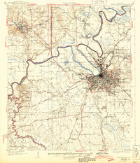
1957 Map of Montgomery
USGS Topo · Published 1957About this map
Alabama River meanders across the heart of central Alabama, connecting the industrial and agricultural hubs of the mid-1950s. The state capital of Montgomery stands as the primary urban center, anchored by the State Capitol and surrounded by a significant military footprint including Maxwell AFB and Gunter AFB. To the west, Selma serves as a vital river crossing, while the heavy timberlands of the Talladega National Forest dominate the northern terrain. This era showcases a landscape defined by its waterways and a dense network of major railroads like the Southern Railway and the Louisville & Nashville RR. Smaller settlements such as Demopolis, Greensboro, and Marion reflect the established rural character of the Black Belt and the transition into the hill country near Clanton. The map captures the region before the completion of the modern interstate system, highlighting the reliance on U.S. Highways and the historic river-and-rail economy.
Find a feature on this map
102 named features on this map. Tap any name to fly to it.
Don’t see what you’re looking for? This feature index may not catch every label — zoom into the map to look around manually.
Map Details
Editions of this 1957 Montgomery Map
This is the sole edition of this map. No revisions or reprints were ever made.
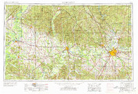
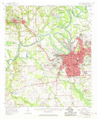
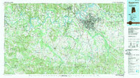
Historical Maps of Montgomery Through Time
7 maps found