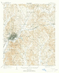
1965 Map of Meridian
USGS Topo · Published 1965About this map
Meridian stands as the primary hub of this East Mississippi and West Alabama survey, where the Southern and Meridian and Bigbee railroads converge. The landscape is defined by the transition from the Pearl River basin in the west to the Tombigbee River drainage in the east. Large tracts of protected land, including the Choctaw Indian Reservation and the Bienville National Forest, dominate the central and northern reaches. The presence of Tuscahoma Landing on the Tombigbee and numerous water bodies like the Sucarnoochee River and Okatibbee Creek reflect the historical reliance on river networks for commerce. From the small-town centers of Philadelphia and Kosciusko to the recreational areas at Roosevelt State Park, the map captures a region balanced between timber resources, small-scale agriculture, and growing post-war transportation corridors like Interstate 20.
Find a feature on this map
90 named features on this map. Tap any name to fly to it.
Don’t see what you’re looking for? This feature index may not catch every label — zoom into the map to look around manually.
Map Details
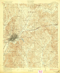
Editions of this 1965 Meridian Map
This is the sole edition of this map. No revisions or reprints were ever made.
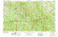
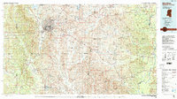
Historical Maps of Meridian Through Time
6 maps found