
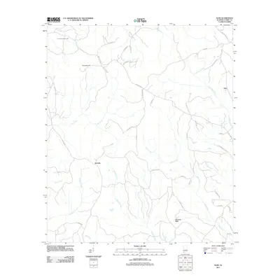
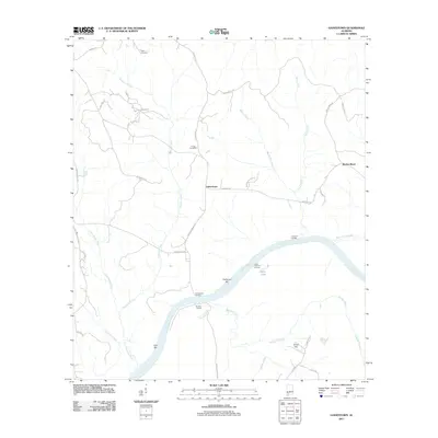
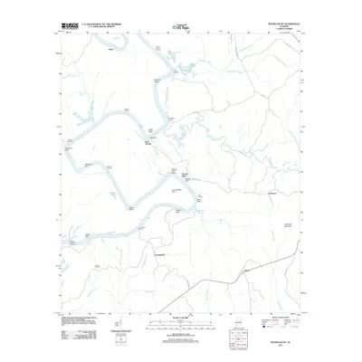
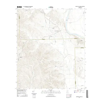
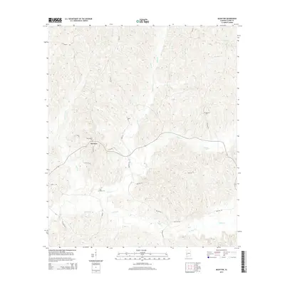
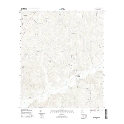
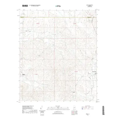
1973 Map of Lower Peach Tree
USGS Topo · Published 1977About this map
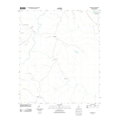
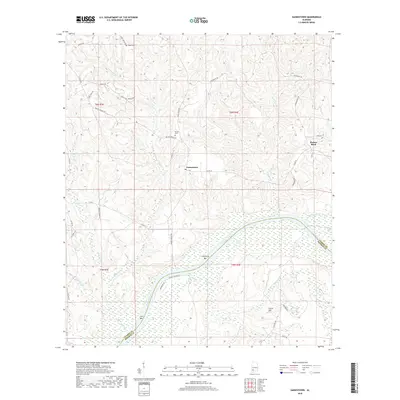
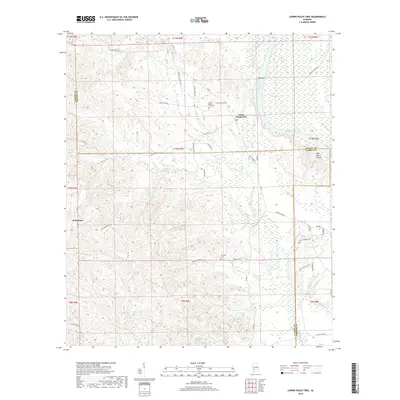
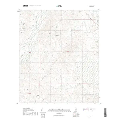
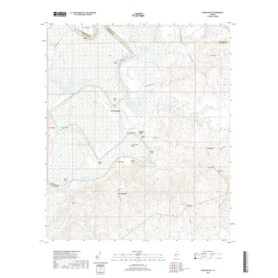
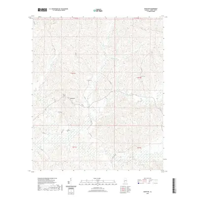
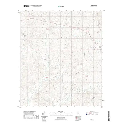
The Alabama River flows through this southwestern Alabama landscape, forming the primary geographic artery for the communities of Lower Peach Tree and Nettleboro. In the early 1970s, the river valley transitioned into the Claiborne Lake reservoir system, supporting local recreation such as the Picnic Area Boat Ramp. The upland terrain is defined by a dense network of churches and burial grounds that anchor the rural social structure, including New Mt Moriah Ch, St Thomas Ch, and the Lower Peach Tree Cem. A historical Indian Treaty Bdy cuts through the western portion of the map, marking an older layer of political geography. Numerous Gravel Pits scattered throughout the hills suggest a local industry reliant on the area's geological deposits, while waterways like Silver Creek and Cane Creek drain the undulating hills into the river basin.
Find a feature on this map
26 named features on this map. Tap any name to fly to it.
Don’t see what you’re looking for? This feature index may not catch every label — zoom into the map to look around manually.
Map Details
Editions of this 1973 Lower Peach Tree Map
This is the sole edition of this map. No revisions or reprints were ever made.
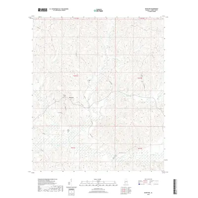
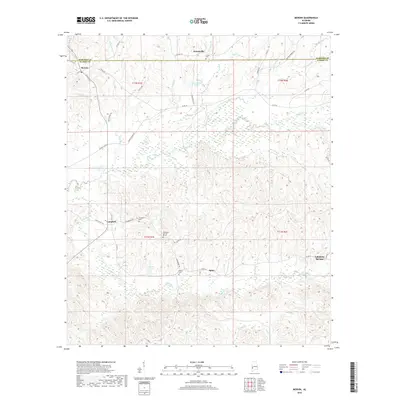
Historical Maps of Nettleboro Through Time
86 maps found

1943 Choctaw Bluff
Clarke County, AL

1946 Choctaw Bluff
Clarke County, AL

1972 Chance
Clarke County, AL

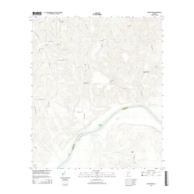
1972 Gainestown
Clarke County, AL

1972 Suggsville
Clarke County, AL

1972 Tattlersville
Clarke County, AL

1972 Woods Bluff
Clarke County, AL

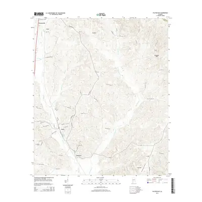
1973 Fulton East
Clarke County, AL
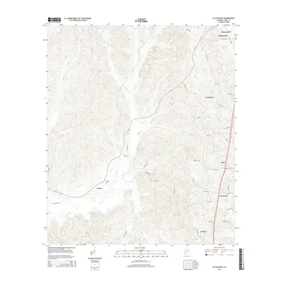
1973 Lower Peach Tree
Clarke County, AL

1978 Bashi
Clarke County, AL

1978 Fulton West
Clarke County, AL

1978 McEntyre
Clarke County, AL

1978 Morvin
Clarke County, AL

1978 Walker Springs
Clarke County, AL

1978 Winn
Clarke County, AL

1983 Choctaw Bluff NE
Clarke County, AL
2011 Alma
Clarke County, AL
2011 Bashi
Clarke County, AL
2011 Chance
Clarke County, AL

2011 Fulton East
Clarke County, AL
2011 Fulton West
Clarke County, AL
2011 Gainestown
Clarke County, AL
2011 Lower Peach Tree
Clarke County, AL
2011 McEntyre
Clarke County, AL
2011 Morvin
Clarke County, AL
2011 Suggsville
Clarke County, AL
2011 Tattlersville
Clarke County, AL
2011 Walker Springs
Clarke County, AL
2011 Winn
Clarke County, AL
2011 Woods Bluff
Clarke County, AL
2014 Alma
Clarke County, AL
2014 Bashi
Clarke County, AL
2014 Chance
Clarke County, AL
2014 Fulton East
Clarke County, AL
2014 Fulton West
Clarke County, AL
2014 Gainestown
Clarke County, AL
2014 Lower Peach Tree
Clarke County, AL
2014 McEntyre
Clarke County, AL
2014 Morvin
Clarke County, AL
2014 Suggsville
Clarke County, AL
2014 Tattlersville
Clarke County, AL
2014 Walker Springs
Clarke County, AL
2014 Winn
Clarke County, AL
2014 Woods Bluff
Clarke County, AL
2018 Alma
Clarke County, AL
2018 Bashi
Clarke County, AL
2018 Chance
Clarke County, AL
2018 Fulton East
Clarke County, AL
2018 Fulton West
Clarke County, AL
2018 Gainestown
Clarke County, AL
2018 Lower Peach Tree
Clarke County, AL
2018 McEntyre
Clarke County, AL
2018 Morvin
Clarke County, AL
2018 Suggsville
Clarke County, AL
2018 Tattlersville
Clarke County, AL
2018 Walker Springs
Clarke County, AL
2018 Winn
Clarke County, AL
2018 Woods Bluff
Clarke County, AL

2020 Alma
Clarke County, AL

2020 Bashi
Clarke County, AL
2020 Chance
Clarke County, AL

2020 Fulton East
Clarke County, AL

2020 Fulton West
Clarke County, AL
2020 Gainestown
Clarke County, AL
2020 Lower Peach Tree
Clarke County, AL
2020 McEntyre
Clarke County, AL
2020 Morvin
Clarke County, AL
2020 Suggsville
Clarke County, AL

2020 Tattlersville
Clarke County, AL
2020 Walker Springs
Clarke County, AL
2020 Winn
Clarke County, AL

2020 Woods Bluff
Clarke County, AL

2024 Alma
Clarke County, AL

2024 Bashi
Clarke County, AL

2024 Chance
Clarke County, AL

2024 Fulton East
Clarke County, AL

2024 Fulton West
Clarke County, AL

2024 Gainestown
Clarke County, AL

2024 Lower Peach Tree
Clarke County, AL

2024 McEntyre
Clarke County, AL

2024 Morvin
Clarke County, AL

2024 Suggsville
Clarke County, AL

2024 Tattlersville
Clarke County, AL

2024 Walker Springs
Clarke County, AL

2024 Winn
Clarke County, AL

2024 Woods Bluff
Clarke County, AL