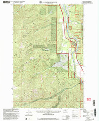
1999 Map of Lozeau
USGS Topo · Published 2003About this map
Clark Fork Fork carves a deep valley through the heart of the Lolo National Forest in this late 20th-century survey of western Montana. The settlement of Lozeau and the station at Westfall anchor the river corridor, while the high country to the west is defined by prominent landmarks like Eagle Rock Saddle and Quartz Peak. This area in Mineral Co shows a landscape managed for both timber and recreation, with the Quartz Work Center and the Forest Grove Fishing Access serving as administrative and public hubs along the water. Genealogists and historians can locate a small Cem near Quartz Flat, and several instances of Mine activity are recorded in the drainage basins of Sunrise Creek and Meadow Creek. The network of forestry roads, including the Superior Ninemile, provides access to the complex gulches and ridges that drain toward the main river fork.
Find a feature on this map
41 named features on this map. Tap any name to fly to it.
Don’t see what you’re looking for? This feature index may not catch every label — zoom into the map to look around manually.
Map Details
Editions of this 1999 Lozeau Map
This is the sole edition of this map. No revisions or reprints were ever made.
Other maps of this area

1911 · Lolo
USGS Topo · 1:250,000

1913 · Lolo
USGS Topo · 1:250,000

1956 · Wallace
USGS Topo · 1:250,000

1956 · Hamilton
USGS Topo · 1:250,000

1959 · Hamilton
USGS Topo · 1:250,000

1959 · Tarkio
USGS Topo · 1:62,500

1960 · Wallace
USGS Topo · 1:250,000

1960 · Hamilton
USGS Topo · 1:250,000

1960 · Superior
USGS Topo · 1:62,500

1960 · Straight Peak
USGS Topo · 1:62,500