2023 Map of Lubeck
USGS Topo · Published 2023About this map
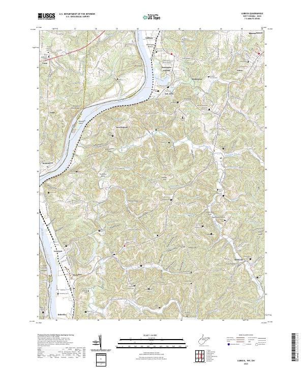
The Ohio River forms a wide, sweeping bend as it passes Blennerhassett and the wooded banks of Mustapha Island, defining the border between West Virginia and Ohio. This riverine landscape is characterized by deep hollows and narrow ridges, such as Youba Ridge and New England Ridge, which channel drainage into complex creek systems like Lee Creek and Sandy Creek. The map documents a dense network of family and community history through its numerous cemeteries, including the Lubeck Cem and the Fort Belleville Cem near the southern river flats. Small settlements like Washington Gardens and Oak Acres contrast with the more traditional rural crossroads of New England and Wadeville. The presence of sites like the Fairview Methodist (Episcopal) Church and various named landforms such as Saddle Back Knob suggest a long-established upland community structured around geography and faith.
Find a feature on this map
217 named features on this map. Tap any name to fly to it.
Don’t see what you’re looking for? This feature index may not catch every label — zoom into the map to look around manually.
Map Details
Editions of this 2023 Lubeck Map
This is the sole edition of this map. No revisions or reprints were ever made.
Historical Maps of Tallmans Through Time

Featured Locations
- Humphrey, WV
- Crystal Spring Lake, WV
- DeMoor Subdivision, WV
- New England Heights Addition, WV
- Wadeville, WV