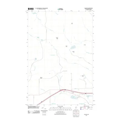
2011 Map of Ludlow
USGS Topo · Published 2011About this map
Ludlow and Smyrna Center serve as the primary hubs in this corner of Aroostook County, where the landscape is defined by a series of prominent elevations and a dense network of brooks. The terrain is marked by distinctive highlands such as Bull Ridge, Number Seven Ridge, and Gardiner Ridge, which separate the various watersheds. Local history is anchored at the Yerxa Cemetery near the crossing of Marley Brook and Ludlow Rd, providing a specific point of interest for genealogists tracking early families in the area.
Find a feature on this map
47 named features on this map. Tap any name to fly to it.
Don’t see what you’re looking for? This feature index may not catch every label — zoom into the map to look around manually.
Map Details
Editions of this 2011 Ludlow Map
This is the sole edition of this map. No revisions or reprints were ever made.
Other maps of this area

1934 · Bridgewater
USGS Topo · 1:48,000

1935 · Howe Brook
USGS Topo · 1:48,000

1937 · Smyrna Mills
USGS Topo · 1:62,500

1938 · Bridgewater
USGS Topo · 1:62,500

1938 · Houlton
USGS Topo · 1:62,500

1939 · Howe Brook
USGS Topo · 1:62,500

1951 · Houlton
USGS Topo · 1:62,500

1951 · Bridgewater
USGS Topo · 1:62,500

1953 · Bridgewater
USGS Topo · 1:50,000

1954 · Howe Brook
USGS Topo · 1:62,500