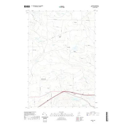
2021 Map of Ludlow
USGS Topo · Published 2021About this map
Smyrna Center and Ludlow anchor this Aroostook County landscape, where the agricultural traditions of Northern Maine are etched into the terrain. The presence of the Amish Cem and Stewart Cem reflects the enduring community roots and genealogy of the region. A network of timber and ridge roads, such as Mansur Brook Rd and No 7 Ridge Rd, cuts through a complex hydraulic system of ponds and wetlands. These water features, including Thousand Acre Swamp and the uniquely named B Lake, define the local drainage patterns into Limestone Brook and Dunn Brook. The elevation is marked by several prominent landforms like Number Seven Ridge and Bull Ridge, which have historically dictated the placement of homesteads and connecting routes like Ludlow Rd and Smyrna Center Rd.
Find a feature on this map
45 named features on this map. Tap any name to fly to it.
Don’t see what you’re looking for? This feature index may not catch every label — zoom into the map to look around manually.
Map Details
Editions of this 2021 Ludlow Map
This is the sole edition of this map. No revisions or reprints were ever made.
Other maps of this area

1934 · Bridgewater
USGS Topo · 1:48,000

1935 · Howe Brook
USGS Topo · 1:48,000

1937 · Smyrna Mills
USGS Topo · 1:62,500

1938 · Bridgewater
USGS Topo · 1:62,500

1938 · Houlton
USGS Topo · 1:62,500

1939 · Howe Brook
USGS Topo · 1:62,500

1951 · Houlton
USGS Topo · 1:62,500

1951 · Bridgewater
USGS Topo · 1:62,500

1953 · Bridgewater
USGS Topo · 1:50,000

1954 · Howe Brook
USGS Topo · 1:62,500